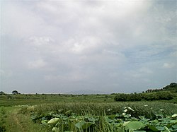
Xiaochang County
Appearance
Xiaochang County
孝昌县 | |
|---|---|
 Skyline of Xiaochang County | |
| Coordinates (Xiaochang government): 31°15′29″N 113°59′53″E / 31.258°N 113.998°E | |
| Country | People's Republic of China |
| Province | Hubei |
| Prefecture-level city | Xiaogan |
| Township-level Divisions | 15 township-level divisions |
| Population (2010)[1] | 588,666 |
| Time zone | UTC+8 (China Standard) |
| Website | www |
Xiaochang County (simplified Chinese: 孝昌县; traditional Chinese: 孝昌縣; pinyin: Xiàochāng Xiàn) is a county of eastern Hubei province, People's Republic of China. It is under the administration of Xiaogan City.
Administrative divisions
[edit]Xiaochang County is divided into 8 towns, 4 townships and 3 other areas:[1][2][3]
- Huayuan (花园镇), Fengshan (丰山镇), Zhouxiang (周巷镇), Xiaohe (小河镇), Wangdian (王店镇), Weidian (卫店镇), Baisha (白沙镇), Zougang (邹岗镇)
Townships:
- Xiaowu Township (小悟乡), Jidian Township (季店乡), Huaxi Township (花西乡), Doushan Township (陡山乡)
Other Areas:
- Xiaochang County Economic Development Area (孝昌县开发区), Shuangyin Lake Ecology & Culture Tourism & Vacation Area (观音湖生态文化旅游渡假区), Shuangfeng Mountain Tourism & Vacation Area (双峰山旅游渡假区)
Climate
[edit]| Climate data for Xiaochang (2009–2020 normals) | |||||||||||||
|---|---|---|---|---|---|---|---|---|---|---|---|---|---|
| Month | Jan | Feb | Mar | Apr | May | Jun | Jul | Aug | Sep | Oct | Nov | Dec | Year |
| Mean daily maximum °C (°F) | 7.9 (46.2) |
11.0 (51.8) |
17.0 (62.6) |
22.7 (72.9) |
27.4 (81.3) |
30.2 (86.4) |
32.5 (90.5) |
33.0 (91.4) |
28.7 (83.7) |
23.4 (74.1) |
16.8 (62.2) |
10.7 (51.3) |
21.8 (71.2) |
| Daily mean °C (°F) | 3.5 (38.3) |
6.4 (43.5) |
11.9 (53.4) |
17.4 (63.3) |
22.5 (72.5) |
25.8 (78.4) |
28.4 (83.1) |
28.2 (82.8) |
23.6 (74.5) |
18.0 (64.4) |
11.5 (52.7) |
5.8 (42.4) |
16.9 (62.4) |
| Mean daily minimum °C (°F) | 0.3 (32.5) |
2.9 (37.2) |
8.0 (46.4) |
13.2 (55.8) |
18.3 (64.9) |
22.2 (72.0) |
25.1 (77.2) |
24.7 (76.5) |
20.1 (68.2) |
14.2 (57.6) |
7.8 (46.0) |
2.3 (36.1) |
13.3 (55.9) |
| Average precipitation mm (inches) | 33.2 (1.31) |
41.1 (1.62) |
60.9 (2.40) |
96.4 (3.80) |
128.6 (5.06) |
163.2 (6.43) |
236.5 (9.31) |
140.4 (5.53) |
62.7 (2.47) |
69.3 (2.73) |
46.5 (1.83) |
17.4 (0.69) |
1,096.2 (43.18) |
| Average precipitation days (≥ 0.1 mm) | 7.9 | 9.3 | 10.5 | 9.3 | 11.8 | 11.0 | 11.6 | 9.4 | 8.1 | 9.3 | 8.6 | 5.9 | 112.7 |
| Average snowy days | 4.2 | 2.4 | 0.5 | 0 | 0 | 0 | 0 | 0 | 0 | 0 | 0.6 | 1.0 | 8.7 |
| Average relative humidity (%) | 70 | 72 | 70 | 70 | 73 | 78 | 80 | 78 | 76 | 73 | 72 | 67 | 73 |
| Mean monthly sunshine hours | 96.0 | 93.9 | 139.6 | 160.8 | 161.4 | 145.4 | 193.2 | 212.2 | 146.1 | 141.4 | 126.5 | 117.7 | 1,734.2 |
| Percent possible sunshine | 30 | 30 | 37 | 41 | 38 | 34 | 45 | 52 | 40 | 40 | 40 | 38 | 39 |
| Source: China Meteorological Administration[4][5] | |||||||||||||
References
[edit]Wikimedia Commons has media related to Xiaochang County.
Look up Xiaochang in Wiktionary, the free dictionary.
- ^ a b 孝昌县历史沿革 [Xiaochang County Historical Development] (in Simplified Chinese). XZQH.org. 6 August 2014. Retrieved 10 April 2018.
2010年第六次人口普查,孝昌县常住总人口588666人,其中:花园镇107709人,丰山镇23100人,周巷镇54161人,小河镇38981人,王店镇39985人,卫店镇27584人,白沙镇43094人,邹岗镇58155人,小悟乡16023人,季店乡44994人,花西乡42493人,陡山乡48179人,孝昌县开发区22225人,观音湖生态文化旅游度假区13060人,双峰山旅游度假区8923人。
- ^ 行政区划 [Administrative Divisions] (in Simplified Chinese). Xiaochang County People's Government. Retrieved 10 April 2018.
孝昌县现辖花园镇、邹岗镇、小河镇、白沙镇、王店镇、卫店镇、周巷镇、丰山镇、陡山乡、季店乡、花西乡、小悟乡共12个乡镇和1个省管经济开发区、1个国家4A级生态旅游区,
- ^ 2017年统计用区划代码和城乡划分代码:孝昌县 [2016 Statistical Area Numbers and Rural-Urban Area Numbers: Xiaochang County] (in Simplified Chinese). National Bureau of Statistics of the People's Republic of China. 2017. Retrieved 15 November 2018.
统计用区划代码 名称 420921100000 花园镇 420921101000 丰山镇 420921102000 周巷镇 420921103000 小河镇 420921104000 王店镇 420921105000 卫店镇 420921106000 白沙镇 420921107000 邹岗镇 420921200000 小悟乡 420921201000 季店乡 420921202000 花西乡 420921203000 陡山乡 420921400000 开发区 420921450000 观音湖生态文化旅游渡假区 420921500000 双峰山旅游渡假区
- ^ 中国气象数据网 – WeatherBk Data (in Simplified Chinese). China Meteorological Administration. Retrieved 12 August 2023.
- ^ 中国气象数据网 (in Simplified Chinese). China Meteorological Administration. Retrieved 12 August 2023.

