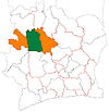
Worofla
Appearance
Worofla | |
|---|---|
Town, sub-prefecture, and commune | |
| Coordinates: 8°16′N 6°54′W / 8.267°N 6.900°W | |
| Country | |
| District | Woroba |
| Region | Worodougou |
| Department | Séguéla |
| Population (2014)[1] | |
| • Total | 44,821 |
| Time zone | UTC+0 (GMT) |
Worofla is a town in western Ivory Coast. It is a sub-prefecture and commune of Séguéla Department in Worodougou Region, Woroba District.
In 2014, the population of the sub-prefecture of Worofla was 44,821.[2]
Villages
[edit]The thirty villages of the sub-prefecture of Worofla and their population in 2014 are:[2]
- Bagabasso (1 177)
- Bananigoro (84)
- Bangana (991)
- Bonna (242)
- Béhéma (2 333)
- Dabala (470)
- Dougougbè (825)
- Gbimanan (4 208)
- Gbémazo (1 381)
- Gbétogo (9 125)
- Kangana (744)
- Karaba (1 107)
- Kato (2 551)
- Kognimasso (342)
- Kohimon (1 632)
- Kondogo (626)
- Kouégo (3 045)
- Kéyé (344)
- Lohou (2 519)
- Mankono (1 576)
- Massala (390)
- Monso (283)
- N'gonwo (570)
- Soko (2 777)
- Séhéla (317)
- Tiéma (1 120)
- Worofla (1 791)
- Yamonzo (881)
- Yanfissa (359)
- Zogbogba (1 011)
Notes
[edit]- ^ "Côte d'Ivoire". geohive.com. Retrieved 14 December 2015.
- ^ a b "RGPH 2014, Répertoire des localités, Région Worodougou" (PDF). ins.ci. Retrieved 5 August 2019.


