Wisteria Park
Appearance
| Wisteria Park | |
|---|---|
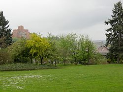
 The park in 2007 | |
 | |
| Location | Central District, Seattle, Washington, U.S. |
| Coordinates | 47°36′00″N 122°18′43″W / 47.600°N 122.312°W |

Wisteria Park (formerly Collins Playfield) is a park in Seattle's Central District,[1] in the U.S. state of Washington.[2] The private parkland[3] is across from the Seattle Betsuin Buddhist Temple and has a bonsho (temple bell).[4][5]
In 2019, the Japanese American Community organized Lights for Liberty at the park.[6]
References
[edit]- ^ "Seattle Neighborhoods: Central Area -- Thumbnail History". www.historylink.org. Archived from the original on 2023-05-29. Retrieved 2023-06-13.
- ^ "A perfect urban walk with a side of history for a sunny Seattle weekend". The Seattle Times. 2021-05-14. Archived from the original on 2022-11-30. Retrieved 2023-06-13.
- ^ "Collins Playfield (now Wisteria Park)". Friends of Seattle's Olmsted Parks. Archived from the original on 2022-12-05. Retrieved 2023-06-13.
- ^ "Ring the temple bell on New Year's Eve". Seattle Betsuin Buddhist Temple. 2012-12-29. Archived from the original on 2023-03-23. Retrieved 2023-06-13.
- ^ Dillinger, Natasha (2022-02-05). "Kids can climb to their hearts' content at Seattle Bouldering Project". Seattle's Child. Archived from the original on 2022-12-01. Retrieved 2023-06-13.
- ^ Kodama, Yuko (2019-07-15). "Lights for Liberty - Seattle Wisteria Park". 91.3 KBCS. Archived from the original on 2023-03-28. Retrieved 2023-06-13.
External links
[edit] Media related to Wisteria Park at Wikimedia Commons
