Wisconsin Highway 149
| Route information | ||||
|---|---|---|---|---|
| Maintained by WisDOT | ||||
| Length | 40.1 mi (64.5 km) | |||
| Existed | 1923–2006 | |||
| Major junctions | ||||
| West end | ||||
| East end | ||||
| Location | ||||
| Country | United States | |||
| State | Wisconsin | |||
| Highway system | ||||
| ||||
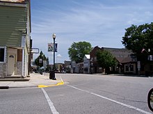
State Trunk Highway 149 (Highway 149, STH-149 or WIS 149) was a state highway in the U.S. state of Wisconsin. It ran through 40.1 miles (64.5 km) of Manitowoc, Calumet, and Fond du Lac counties.
History
[edit]

In 1923, WIS 149 ran from WIS 57 (today's WIS 32/WIS 57) in Kiel to WIS 17 (then US 141, now Westview Street east of today's I-43) in St. Wendel (now Cleveland).[1][2] In 1938, part of the route near Kiel was straightened to follow today's County Trunk Highway XX (CTH-XX).[3][4] In 1947, WIS 149 was extended westward to US 151/WIS 55 (now just US 151) in Peebles, superseding CTH-U, CTH-I, and a part of CTH-HH. Also, WIS 149 was extended eastward via Westvie Street and Washington Street to present-day CTH-LS just west of the shore of Lake Michigan.[5][6] In 1979, WIS 149 was removed east of the newly built I-43. As a result, the former connection to Cleveland was downgraded to CTH-XX.[7][8] By 1987, WIS 149 was shortened even further to end at WIS 32/WIS 57 in Kiel. As a result, CTH-XX extended west to WIS 67 near Kiel.[9][10]
The road was turned back to local control in 2006. The highway, since then, was designated as multiple county routes. County HH was extended from Marytown to Kiel, Fond du Lac County G took over primary signage on the portion concurrent with the highway (from Marytown to just west of St. Joe), and Fond du Lac County created County WH for the remainder.[11]
Major intersections
[edit]This junction list shows the pre-1987 routing.
| County | Location | mi | km | Destinations | Notes |
|---|---|---|---|---|---|
| Fond du Lac | Peebles | ||||
| Manitowoc | Kiel | Western end of WIS 32/57 concurrency | |||
| Eastern end of WIS 32/57 concurrency; southern end of WIS 67 concurrency | |||||
| Northern end of WIS 67 concurrency | |||||
| Meeme | Northern end of WIS 42 concurrency | ||||
| Southern end of WIS 42 concurrency | |||||
| Cleveland | |||||
| 1.000 mi = 1.609 km; 1.000 km = 0.621 mi | |||||
See also
[edit]References
[edit]- ^ Wisconsin Highway Commission (1923). Official Map of the State Trunk Highway System of Wisconsin (PDF) (Map). Scale not given. Madison: Wisconsin Highway Commission. Retrieved February 5, 2023 – via Wikimedia Commons.
- ^ Wisconsin Highway Commission (1924). Official Highway Map of Wisconsin: 'The Playground of the Middle West' (PDF) (Map). c. 1:950,400. Madison: Wisconsin Highway Commission. OCLC 560719947. Retrieved March 19, 2021 – via Wikimedia Commons.
- ^ State Highway Commission of Wisconsin (January 1, 1938). Official Highway Map of Wisconsin (PDF) (Map). 1:823,680. Madison: State Highway Commission of Wisconsin. Retrieved February 5, 2023 – via Wikimedia Commons.
- ^ State Highway Commission of Wisconsin (1939). Official Highway Service Map of Wisconsin (PDF) (Map). 1:538,560. Madison: State Highway Commission of Wisconsin. Retrieved March 19, 2021 – via Wikimedia Commons.
- ^ State Highway Commission of Wisconsin (January 1947). Official Highway Map of Wisconsin (PDF) (Map). 1:887,040. Madison: State Highway Commission of Wisconsin. Retrieved March 19, 2021 – via Wikimedia Commons.
- ^ State Highway Commission of Wisconsin (January 1948). Official Highway Map of Wisconsin (PDF) (Map). 1:887,040. Madison: State Highway Commission of Wisconsin. OCLC 232303069. Retrieved March 19, 2021 – via Wikimedia Commons.
- ^ Wisconsin Department of Transportation Division of Highways (1978). Wisconsin Highway Map (PDF) (Map) (1978–1979 ed.). 1:823,680. Madison: Wisconsin Department of Transportation. OCLC 174123957. Retrieved March 19, 2021.
- ^ Wisconsin Department of Transportation Division of Highways (1980). Wisconsin Highway Map (PDF) (Map) (1980–1981 ed.). 1:823,680. Madison: Wisconsin Department of Transportation. OCLC 613423704, 77526920. Retrieved March 19, 2021.
- ^ Wisconsin Department of Transportation Division of Highways (1983). Wisconsin Highway Map (PDF) (Map) (1983–1984 ed.). 1:823,680. Madison: Wisconsin Department of Transportation. OCLC 713016540, 381172055. Retrieved March 19, 2021.
- ^ Wisconsin Department of Transportation Division of Highways (1987). Wisconsin Highway Map (Map) (1987–1988 ed.). 1:823,680. Madison: Wisconsin Department of Transportation. OCLC 314276560, 17746029. Retrieved March 19, 2021 – via American Geographical Society Library Digital Map Collection.
- ^ Bessert, Chris. "Highways 140–149". Wisconsin Highways. Retrieved March 20, 2007.[self-published source]
External links
[edit] Media related to Wisconsin Highway 149 at Wikimedia Commons

