Williamstown, Ohio
Appearance
Williamstown, Ohio | |
|---|---|
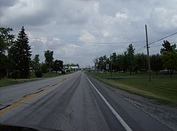
 Coming into Williamstown from the south | |
| Nickname: Billtown | |
 Location of Williamstown, Ohio | |
| Coordinates: 40°50′02″N 83°39′03″W / 40.8338889°N 83.6508333°W | |
| Country | |
| U.S. state | Ohio |
| County | Hancock County |
| Township | Madison Township |
| Founded by | John W. Williams |
Williamstown is an unincorporated community in southern Madison Township, Hancock County, Ohio, United States.[1] Although it is unincorporated, it has its own zip code of 45897.[2] It lies at the intersection of U.S. Routes 30 and 68.
History
[edit]Williamstown was laid out in 1834 by John W. Williams, and named for him.[3] A post office called Eagle was established in 1834, and the name was changed to Williamstown in 1868.[4] The post office service was suspended in 2007 and it was discontinued in 2009.[5]
References
[edit]- ^ U.S. Geological Survey Geographic Names Information System: Williamstown
- ^ USPS – Cities by ZIP Code
- ^ History of Hancock County, Ohio: Containing a History of the County, Its Townships, Towns. Warner, Beers. 1886. p. 448.
- ^ U.S. Geological Survey Geographic Names Information System: Williamstown Post Office
- ^ (USPS Postal Bulletin #22280)

