Wikipedia talk:WikiProject Maps/Conventions/Historical maps
Appearance
| This project page does not require a rating on Wikipedia's content assessment scale. It is of interest to the following WikiProjects: | ||||||||
| ||||||||
Historical maps
[edit]To expand this style, the following tools may help:
- Tango Icon Theme Guidelines
- Tango-Palette.svg (SVG) & Tango-Palette.gpl (file .gpl) to install in Gimp and Inkscape
- commons:Category:Maps from Meyers Konversationslexikon
- Possible icons
- French discussion (not finished)
-
Palette tango
-
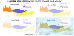
Test upon location and topo background needed.
- Color Use Guidelines for Mapping and Visualization, et ColorBrewer2.org (color-blind friendly !), par Cynthia Brewer ! Chercheuse américaine: map design, color theory in cartography, topographic map design, multi-scale mapping, generalization, atlas mapping, choropleth classification for maps in series. Yug (talk) 21 mai 2012 à 13:34 (CEST)
- File:Indonesia provinces location map-en.svg for water borders


