West Freemason Street Area Historic District
Appearance
West Freemason Street Area Historic District | |
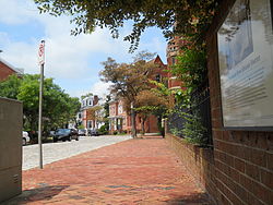
 W. Freemason St. Historic District, September 2013 | |
| Location | Both sides of Bute and Freemason Sts. between Elizabeth River, and York and Duke Sts., Norfolk, Virginia |
|---|---|
| Coordinates | 36°51′08″N 76°17′40″W / 36.85222°N 76.29444°W |
| Area | 40 acres (16 ha) |
| Architectural style | Late Victorian, Greek Revival, Federal |
| NRHP reference No. | 72001512[1] |
| VLR No. | 122-0060 |
| Significant dates | |
| Added to NRHP | November 7, 1972 |
| Designated VLR | December 21, 1971[2] |
The West Freemason Street Area Historic District is a national historic district located at Norfolk, Virginia. It encompasses 48 contributing buildings in a primarily residential section on the western edge of the center city of Norfolk. It developed between the late-18th and early-20th centuries and includes notable examples of the Federal, Greek Revival, and Late Victorian styles. Notable buildings include Kenmure House Glisson House, Whittle House, McCullough Row, and the Camp-Hubard house. Located in the district is the separately listed Allmand-Archer House.[3]
It was listed on the National Register of Historic Places in 1972.[1]
References
[edit]- ^ a b "National Register Information System". National Register of Historic Places. National Park Service. July 9, 2010.
- ^ "Virginia Landmarks Register". Virginia Department of Historic Resources. Retrieved March 19, 2013.
- ^ Virginia Historic Landmarks Commission Staff (November 1971). "National Register of Historic Places Inventory/Nomination: West Freemason Street Area Historic District" (PDF). Virginia Department of Historic Resources. and Accompanying photo and Accompanying map
External links
[edit]![]() Media related to West Freemason Street Area Historic District at Wikimedia Commons
Media related to West Freemason Street Area Historic District at Wikimedia Commons
- Whittle House, 225 West Freemason Street, Norfolk, Norfolk, VA: 1 photo, 5 measured drawings, and 3 data pages at Historic American Buildings Survey
Categories:
- Houses on the National Register of Historic Places in Virginia
- Historic districts on the National Register of Historic Places in Virginia
- National Register of Historic Places in Norfolk, Virginia
- Federal architecture in Virginia
- Greek Revival architecture in Virginia
- Victorian architecture in Virginia
- Neighborhoods in Norfolk, Virginia
- Houses in Norfolk, Virginia
- Hampton Roads, Virginia Registered Historic Place stubs


