Watson Pond State Park
Appearance
| Watson Pond State Park | |
|---|---|
 The pavilion at Watson Pond | |
| Location | Taunton, Bristol, Massachusetts, United States |
| Coordinates | 41°57′00″N 71°06′51″W / 41.95000°N 71.11417°W[1] |
| Area | 10 acres (4.0 ha) |
| Elevation | 75 ft (23 m)[1] |
| Established | Unspecified |
| Governing body | Massachusetts Department of Conservation and Recreation |
| Website | Watson Pond State Park |
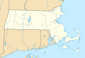
Watson Pond State Park is a public recreation area occupying ten acres (4.0 ha) on the east side of Watson Pond in the northern portion of the city of Taunton, Massachusetts. The state park comprises a 300-foot (91 m) swimming beach, picnic area, bathhouse and pavilion. Fishing and non-motorized boating are offered.[2]
In the news
[edit]In 2006, Watson Pond was reopened for swimming after being closed for 18 years as result of a high bacterial count.[3] In 2010, the park was one of a thousand places given favorable mention by the Great Places in Massachusetts Commission.[4]
References
[edit]- ^ a b "Watson Pond State Park". Geographic Names Information System. United States Geological Survey, United States Department of the Interior.
- ^ "Watson Pond State Park". MassParks. Executive Office of Energy and Environmental Affairs, Department of Conservation and Recreation. Retrieved November 6, 2018.
- ^ "Taunton council wants longer hours, tougher parking enforcement at Watson Pond State Park". Taunton Gazette. April 19, 2017. Retrieved November 6, 2018.
- ^ "1,000 Places to Visit in Massachusetts". Boston.com. Retrieved November 6, 2018.
External links
[edit]- Watson Pond State Park Department of Conservation and Recreation


