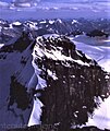
Walter Peak (Canada)
Appearance
| Walter Peak | |
|---|---|
 | |
| Highest point | |
| Elevation | 3,401 m (11,158 ft)[1][2] |
| Prominence | 143 m (469 ft)[3] |
| Parent peak | Mount Lyell (3498 m) |
| Listing | |
| Coordinates | 51°57′08″N 117°06′08″W / 51.95222°N 117.10222°W[4] |
| Geography | |
| Country | Canada |
| Provinces | Alberta and British Columbia |
| Parent range | Canadian Rockies |
| Topo map | NTS 82N14 Rostrum Peak[4] |
| Climbing | |
| First ascent | 1927 D. Duncan, T. Lynes, J. Simpson, guided by Ernest Feuz[2] |
Walter Peak - a.k.a. Lyell 4 or L4 - is the fourth highest of five distinct subpeaks on Mount Lyell, three of which are located on the border of Alberta and British Columbia (Christian, Walter and Ernest Peaks). It was named in 1972 by Sydney R. Vallance after Walter Feuz, an early mountain guide in the Rockies.[2][3]
"Walter Feuz (1894-1986) never took out an official guide's license since he was underage when he left his family home in Interlaken, CH, but was trained up for the work by his older brothers, Edward, Jr. and Ernest."[5]
Geology and climate
[edit]Due to the close proximity of this peak to the central and highest peak (0.6 km (0.4 mi)), see Mount Lyell for geology and climate.
Gallery
[edit]-
Mount Lyell and its 5 subpeaks: L1-L5
-
Mount Lyell 4 (Walter Peak) from Lyell 3 (Ernest Peak); (i.e. Mt. Lyell's summit)
See also
[edit]References
[edit]- ^ "Topographic map of Walter Peak". opentopomap.org. Retrieved 2022-02-19.
- ^ a b c "Walter Peak". cdnrockiesdatabases.ca. Retrieved 2010-02-08.
- ^ a b "Walter Peak". Bivouac.com. Retrieved 2010-02-08.
- ^ a b "Walter Peak (Alberta)". Geographical Names Data Base. Natural Resources Canada. Retrieved 2022-02-19.
- ^ "Boles, Glen W.; Laurilla, Roger W.; Putnam, William L. (1990). Place Names of the Canadian Alps. Revelstoke, B.C.: Footprint Publishing. p. 352. ISBN 0-9691621-4-6.
External links
[edit]- "Walter Peak". BC Geographical Names.
- Walter Peak photo - the right-most peak only (Christian Peak - AKA Lyell 5 - is on the left): Flickr


