Wisconsin's 7th congressional district
| Wisconsin's 7th congressional district | |
|---|---|
Interactive map of district boundaries since January 3, 2023 | |
| Representative | |
| Area | 18,786.53 sq mi (48,656.9 km2) |
| Distribution |
|
| Population (2023) | 747,209 |
| Median household income | $71,320[1] |
| Ethnicity |
|
| Cook PVI | R+12[2] |
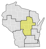
Wisconsin's 7th congressional district is a congressional district of the United States House of Representatives in northwestern and central Wisconsin; it is the largest congressional district in the state geographically, covering 20 counties (in whole or part), for a total of 18,787 sq mi. The district contains the following counties: Ashland, Barron, Bayfield, Burnett, St. Croix, Chippewa (partial), Clark, Douglas, Florence, Forest, Iron, Jackson (partial), Juneau (partial), Langlade, Lincoln, Marathon, Monroe (partial), Oneida, Polk, Price, Rusk, Sawyer, Taylor, Vilas, Washburn, and Wood (partial).
The district is currently represented by Republican Tom Tiffany.
While in 2008, the district gave 56% of the vote to Barack Obama, it has swung to the Republicans in recent presidential elections with Mitt Romney winning with 51% of the vote in 2012 and Donald Trump winning with 58% of the vote in 2016. Additionally, left-leaning Portage County (which contains the city of Stevens Point) was removed from the 7th and added to the 3rd during the hotly contested 2013 redistricting. Since these shifts, the rural 7th has surpassed the suburban 5th as the most Republican district in Wisconsin.
Agriculture is a major industry and employer in the rural 7th district.[3] This district has been a major producer of milk from cows, grains, oilseeds, dry beans, and dry peas.[4] 60% of the farmland in this district is used for crop production, another major economic stimulant.
Counties and municipalities within the district
[edit]| # | County | Seat | Population |
|---|---|---|---|
| 3 | Ashland | Ashland | 16,107 |
| 5 | Barron | Barron | 46,719 |
| 7 | Bayfield | Washburn | 16,320 |
| 13 | Burnett | Siren | 16,744 |
| 17 | Chippewa | Chippewa Falls | 66,865 |
| 19 | Clark | Neillsville | 34,746 |
| 31 | Douglas | Superior | 44,203 |
| 37 | Florence | Florence | 4,593 |
| 41 | Forest | Crandon | 9,258 |
| 51 | Iron | Hurley | 6,178 |
| 53 | Jackson | Black River Falls | 21,121 |
| 57 | Juneau | Mauston | 26,802 |
| 67 | Langlade | Antigo | 19,502 |
| 69 | Lincoln | Merrill | 28,541 |
| 73 | Marathon | Wausau | 137,648 |
| 81 | Monroe | Sparta | 46,193 |
| 85 | Oneida | Rhinelander | 38,259 |
| 95 | Polk | Balsam Lake | 45,431 |
| 99 | Price | Phillips | 14,050 |
| 107 | Rusk | Ladysmith | 14,123 |
| 113 | Sawyer | Hayward | 18,295 |
| 109 | St. Croix | Hudson | 95,044 |
| 119 | Taylor | Medford | 19,923 |
| 125 | Vilas | Eagle River | 23,520 |
| 129 | Washburn | Shell Lake | 16,752 |
| 141 | Wood | Wisconsin Rapids | 74,070 |
- Almena, Barron, Cameron, Chetek, Cumberland, Dallas, Haugen, Prairie Farm, Rice Lake, and Turtle Lake.
- Grantsburg, Siren, and Webster.
- Abbotsford (Clark County side), Colby, Curtiss, Dorchester, Granton, Greenwood, Loyal, Neillsville, Owen, Thorp, and Withee.
- Lake Nebagamon, Oliver, Poplar, Solon Springs, and Superior.
- Alma, Bear Bluff, City Point, Cleveland, Garden Valley, Knapp, and Merrillan (part).
- Armenia, Clearfield (most), Cutler, Finley, Germantown (half), Kingston, and Necedah.
- Antigo and White Lake.
- Athens, Edgar, Elderon, Fenwood, Hatley, Marathon City, Mosinee, Rothschild, Schofield, Spencer, Stratford, Unity, and Wausau.
- Amery, Balsam Lake, Centuria, Clayton, Clear Lake, Dresser, Frederic, Luck, Osceola, and St. Croix Falls.
- Catawba, Kennan, Park Falls, Phillips, and Prentice.
- Bruce, Conrath, Glen Flora, Hawkins, Ingram, Ladysmith, Sheldon, Tony, and Weyerhaeuser.
- Baldwin, Deer Park, Glenwood City, Hammond, Hudson, New Richmond, North Hudson, River Falls (St. Croix side), Roberts, Somerset, Spring Valley (St. Croix side), Star Prairie, Wilson, and Woodville.
- Gilman, Lublin, Medford, Rib Lake, and Stetsonville.
- Arbor Vitae, Boulder Junction, Cloverland, Conover, Eagle River, Lac du Flambeau, Land O' Lakes, Lincoln, Manitowish Waters, Phelps, Plum Lake, Presque Isle, St. Germain, and Washington.
- Birchwood, Minong, Shell Lake, and Spooner.
- Arpin, Auburndale, Hewitt, Marshfield, and Pittsville.
List of members representing the district
[edit]| Member | Party | Years | Cong ress |
Electoral history | District |
|---|---|---|---|---|---|
| District established March 4, 1873 | |||||
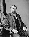 Jeremiah Rusk (Viroqua) |
Republican | March 4, 1873 – March 3, 1877 |
43rd 44th |
Redistricted from the 6th district and re-elected in 1872. Re-elected in 1874. Retired. |
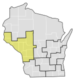 |
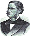 Herman L. Humphrey (Hudson) |
Republican | March 4, 1877 – March 3, 1883 |
45th 46th 47th |
Elected in 1876. Re-elected in 1878. Re-elected in 1880. Lost renomination. | |
 Gilbert M. Woodward (La Crosse) |
Democratic | March 4, 1883 – March 3, 1885 |
48th | Elected in 1882. Lost re-election. |
 |
 Ormsby B. Thomas (Prairie du Chien) |
Republican | March 4, 1885 – March 3, 1891 |
49th 50th 51st |
Elected in 1884. Re-elected in 1886. Re-elected in 1888. Lost re-election. | |
 Frank P. Coburn (West Salem) |
Democratic | March 4, 1891 – March 3, 1893 |
52nd | Elected in 1890. Lost re-election. | |
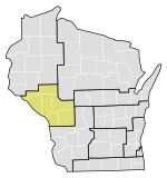
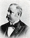 George B. Shaw (Eau Claire) |
Republican | March 4, 1893 – August 27, 1894 |
53rd | Elected in 1892. Died. |
 |
| Vacant | August 27, 1894 – November 5, 1894 |
||||
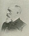 Michael Griffin (Eau Claire) |
Republican | November 5, 1894 – March 3, 1899 |
53rd 54th 55th |
Elected to finish Shaw's term. Also elected to the next full term. Re-elected in 1896. Retired. | |
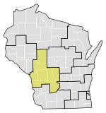
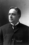 John J. Esch (La Crosse) |
Republican | March 4, 1899 – March 3, 1921 |
56th 57th 58th 59th 60th 61st 62nd 63rd 64th 65th 66th |
Elected in 1898. Re-elected in 1900. Re-elected in 1902. Re-elected in 1904. Re-elected in 1906. Re-elected in 1908. Re-elected in 1910. Re-elected in 1912. Re-elected in 1914. Re-elected in 1916. Re-elected in 1918. Lost renomination. | |
 | |||||
 | |||||
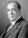 Joseph D. Beck (Viroqua) |
Republican | March 4, 1921 – March 3, 1929 |
67th 68th 69th 70th |
Elected in 1920. Re-elected in 1922. Re-elected in 1924. Re-elected in 1926. Retired to run for Governor of Wisconsin. | |
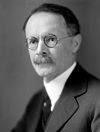 Merlin Hull (Black River Falls) |
Republican | March 4, 1929 – March 3, 1931 |
71st | Elected in 1928. Lost renomination. | |
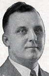 Gardner R. Withrow (La Crosse) |
Republican | March 4, 1931 – March 3, 1933 |
72nd | Elected in 1930. Redistricted to the 3rd district. | |
 Gerald J. Boileau (Wausau) |
Republican | March 4, 1933 – January 3, 1935 |
73rd 74th 75th |
Redistricted from the 8th district and re-elected in 1932. Re-elected in 1934. Re-elected in 1936. Lost re-election. |
 |
| Progressive | January 3, 1935 – January 3, 1939 | ||||
 Reid F. Murray (Ogdensburg) |
Republican | January 3, 1939 – April 29, 1952 |
76th 77th 78th 79th 80th 81st 82nd |
Elected in 1938. Re-elected in 1940. Re-elected in 1942. Re-elected in 1944. Re-elected in 1946. Re-elected in 1948. Re-elected in 1950. Died. | |
| Vacant | April 29, 1952 – January 3, 1953 |
82nd | |||
 Melvin Laird (Marshfield) |
Republican | January 3, 1953 – January 21, 1969 |
83rd 84th 85th 86th 87th 88th 89th 90th 91st |
Elected in 1952. Re-elected in 1954. Re-elected in 1956. Re-elected in 1958. Re-elected in 1960. Re-elected in 1962. Re-elected in 1964. Re-elected in 1966. Re-elected in 1968. Resigned to become U.S. Secretary of Defense. | |
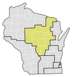 | |||||
| Vacant | January 21, 1969 – April 1, 1969 |
91st | |||
 Dave Obey (Wausau) |
Democratic | April 1, 1969 – January 3, 2011 |
91st 92nd 93rd 94th 95th 96th 97th 98th 99th 100th 101st 102nd 103rd 104th 105th 106th 107th 108th 109th 110th 111th |
Elected to finish Laird's term. Re-elected in 1970. Re-elected in 1972. Re-elected in 1974. Re-elected in 1976. Re-elected in 1978. Re-elected in 1980. Re-elected in 1982. Re-elected in 1984. Re-elected in 1986. Re-elected in 1988. Re-elected in 1990. Re-elected in 1992. Re-elected in 1994. Re-elected in 1996. Re-elected in 1998. Re-elected in 2000. Re-elected in 2002. Re-elected in 2004. Re-elected in 2006. Re-elected in 2008. Retired. | |
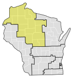 most of Oneida County
| |||||
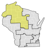
| |||||
1993–2003 | |||||
2003–2013 | |||||
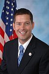 Sean Duffy (Wausau) |
Republican | January 3, 2011 – September 23, 2019 |
112th 113th 114th 115th 116th |
Elected in 2010. Re-elected in 2012. Re-elected in 2014. Re-elected in 2016. Re-elected in 2018. Resigned due to family health issues. | |
2013–2023 | |||||
| Vacant | September 23, 2019 – May 19, 2020 |
116th | |||
 Tom Tiffany (Minocqua) |
Republican | May 19, 2020 – present |
116th 117th 118th |
Elected to finish Duffy's term. Re-elected in 2020. Re-elected in 2022. | |
2023–present | |||||
Recent election results
[edit]2002 district boundaries (2002–2011)
[edit]| Year | Date | Elected | Defeated | Total | Plurality | ||||||
|---|---|---|---|---|---|---|---|---|---|---|---|
| 2002[5] | Nov. 5 | Dave Obey (inc) | Democratic | 146,364 | 64.21% | Joe Rothbauer | Rep. | 81,518 | 35.76% | 227,955 | 64,846 |
| 2004[6] | Nov. 2 | Dave Obey (inc) | Democratic | 241,306 | 85.64% | Mike Miles | Grn. | 26,518 | 9.41% | 281,752 | 214,788 |
| Larry Oftedahl | Con. | 12,841 | 4.56% | ||||||||
| 2006[7] | Nov. 7 | Dave Obey (inc) | Democratic | 161,903 | 62.17% | Nick Reid | Rep. | 91,069 | 34.97% | 260,428 | 70,834 |
| Mike Miles | Grn. | 7,391 | 2.84% | ||||||||
| 2008[8] | Nov. 4 | Dave Obey (inc) | Democratic | 212,666 | 60.79% | Dan Mielke | Rep. | 136,938 | 39.14% | 349,837 | 75,728 |
| 2010[9] | Nov. 2 | Sean Duffy | Republican | 132,551 | 52.11% | Julie Lassa | Dem. | 113,018 | 44.43% | 254,389 | 19,533 |
| Gary Kauther | Ind. | 8,397 | 3.30% | ||||||||
2011 district boundaries (2012–2021)
[edit]| Year | Date | Elected | Defeated | Total | Plurality | ||||||
|---|---|---|---|---|---|---|---|---|---|---|---|
| 2012[10] | Nov. 6 | Sean Duffy (inc) | Republican | 201,720 | 56.08% | Pat Kreitlow | Dem. | 157,524 | 43.80% | 359,669 | 44,196 |
| Dale C. Lehner (write-in) | Ind. | 20 | 0.01% | ||||||||
| 2014[11] | Nov. 4 | Sean Duffy (inc) | Republican | 169,891 | 59.28% | Kelly Westlund | Dem. | 112,949 | 39.41% | 286,603 | 56,942 |
| Lawrence Dale | Ind. | 3,686 | 1.29% | ||||||||
| Tob Taylor (write-in) | Ind. | 30 | 0.01% | ||||||||
| John Schiess (write-in) | Ind. | 5 | 0.00% | ||||||||
| 2016[12] | Nov. 8 | Sean Duffy (inc) | Republican | 223,418 | 61.67% | Mary Hoeft | Dem. | 138,643 | 38.27% | 362,271 | 84,775 |
| 2018[13] | Nov. 6 | Sean Duffy (inc) | Republican | 194,061 | 60.11% | Margaret Engebretson | Dem. | 124,307 | 38.50% | 322,840 | 69,754 |
| Ken Driessen | Ind. | 4,416 | 1.37% | ||||||||
| 2020[14] (special) | May 12 | Tom Tiffany | Republican | 109,498 | 57.11% | Tricia Zunker | Dem. | 82,135 | 42.84% | 191,720 | 27,363 |
| Michael Opela (write-in) | Rep. | 3 | 0.00% | ||||||||
| Dennis Paulaha (write-in) | Ind. | 2 | 0.00% | ||||||||
| 2020[15] | Nov. 3 | Tom Tiffany (inc) | Republican | 252,048 | 60.73% | Tricia Zunker | Dem. | 162,741 | 39.21% | 415,007 | 89,307 |
2022 district boundaries (2022–2031)
[edit]| Year | Date | Elected | Defeated | Total | Plurality | ||||||
|---|---|---|---|---|---|---|---|---|---|---|---|
| 2022[16] | Nov. 8 | Tom Tiffany (inc) | Republican | 209,224 | 61.85% | Richard Dick Ausman | Dem. | 128,877 | 38.10% | 338,268 | 80,347 |
Election results from recent statewide races
[edit]| Year | Results |
|---|---|
| 2000 | Gore 48 - 47% |
| 2004 | Kerry 50 - 49% |
| 2008 | Obama 56 - 43% |
| 2012 | Romney 51 - 48% |
| 2016 | Trump 58 - 37% |
| 2020 | Trump 59 - 39% |
See also
[edit]References
[edit]- General
- Martis, Kenneth C. (1989). The Historical Atlas of Political Parties in the United States Congress. New York: Macmillan Publishing Company.
- Martis, Kenneth C. (1982). The Historical Atlas of United States Congressional Districts. New York: Macmillan Publishing Company.
- Congressional Biographical Directory of the United States 1774–present
- Specific
- ^ "My Congressional District".
- ^ "2022 Cook PVI: District Map and List". Cook Political Report. Retrieved January 10, 2023.
- ^ "The Future of Farming and Rural Life in Wisconsin: Findings, Recommendations, Steps to a Healthy Future" (PDF).
- ^ "2012 Congressional District Profiles" (PDF). United States Department of Agriculture - National Agricultural Statistics Service.
- ^ Results of Fall General Election - 11/05/2002 (PDF) (Report). Wisconsin State Elections Board. December 2, 2002. p. 5. Retrieved April 10, 2022.
- ^ Results of Fall General Election - 11/02/2004 (PDF) (Report). Wisconsin State Elections Board. December 1, 2004. p. 5. Retrieved September 23, 2021.
- ^ Results of Fall General Election - 11/07/2006 (PDF) (Report). Wisconsin State Elections Board. December 5, 2006. p. 6. Retrieved September 23, 2021.
- ^ Results of Fall General Election - 11/04/2008 (PDF) (Report). Wisconsin State Elections Board. December 1, 2008. p. 7. Retrieved September 23, 2021.
- ^ 2010 Fall General Election Results Summary (PDF) (Report). Wisconsin Government Accountability Board. October 4, 2010. pp. 3–4. Retrieved September 23, 2021.
- ^ Canvass Results for 2012 Presidential and General Election - 11/6/2012 (PDF) (Report). Wisconsin Government Accountability Board. November 6, 2012. p. 4. Retrieved September 23, 2021.
- ^ Canvass Results for 2014 General Election - 11/4/2014 (PDF) (Report). Wisconsin Government Accountability Board. November 26, 2014. pp. 4–5. Retrieved September 23, 2021.
- ^ Canvass Results for 2016 General Election - 11/8/2016 (PDF) (Report). Wisconsin Elections Commission. December 22, 2016. pp. 4–5. Retrieved September 23, 2021.
- ^ Canvass Results for 2018 General Election - 11/6/2018 (PDF) (Report). Wisconsin Elections Commission. February 22, 2019. p. 5. Retrieved September 23, 2021.
- ^ Canvass Results for 2020 Special Election Representative in Congress District 7 - 5/12/2020 (PDF) (Report). Wisconsin Elections Commission. June 10, 2020. p. 1. Retrieved April 10, 2022.
- ^ Canvass Results for 2020 General Election - 11/3/2020 (PDF) (Report). Wisconsin Elections Commission. November 18, 2020. p. 2. Retrieved September 23, 2021.
- ^ Canvass Results for 2022 General Election - 11/8/2022 (PDF) (Report). Wisconsin Elections Commission. November 30, 2022. p. 4. Retrieved July 5, 2024.
External links
[edit]- Congressional districts of Wisconsin
- Ashland County, Wisconsin
- Barron County, Wisconsin
- Bayfield County, Wisconsin
- Burnett County, Wisconsin
- Chippewa County, Wisconsin
- Clark County, Wisconsin
- Douglas County, Wisconsin
- Iron County, Wisconsin
- Langlade County, Wisconsin
- Lincoln County, Wisconsin
- Marathon County, Wisconsin
- Polk County, Wisconsin
- Price County, Wisconsin
- Rusk County, Wisconsin
- Sawyer County, Wisconsin
- Taylor County, Wisconsin
- Wood County, Wisconsin


