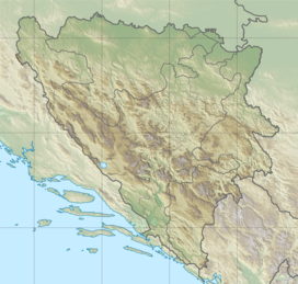
Vlasulja
Appearance
| Vlasulja | |
|---|---|
 Mountain Vlasulja (2336 m) in Volujak Mts. from Trnovački Durmitor (2235 m). | |
| Highest point | |
| Elevation | 2,314 m (7,592 ft) |
| Coordinates | 43°13′58″N 18°42′55″E / 43.2328°N 18.7153°E |
| Geography | |
| Parent range | Dinaric Alps |
Vlasulja is a mountain in the municipality of Foča, Bosnia and Herzegovina. It has an altitude of 2,314 metres (7,592 ft).[1]
See also
[edit]References
[edit]- ^ "Statistical Yearbook of the Federation of Bosnia and Herzegovina" (PDF). Federation of Bosnia and Herzegovina, Federal Office of Statistics. 2009. p. 28. Archived from the original (PDF) on 2011-06-29. Retrieved 2010-03-07.

