Vir pri Stični
Appearance
Vir pri Stični
Vir (until 1953) | |
|---|---|
 | |
| Coordinates: 45°56′50.63″N 14°49′5.24″E / 45.9473972°N 14.8181222°E | |
| Country | |
| Traditional region | Lower Carniola |
| Statistical region | Central Slovenia |
| Municipality | Ivančna Gorica |
| Area | |
• Total | 1.14 km2 (0.44 sq mi) |
| Elevation | 330.2 m (1,083.3 ft) |
| Population (2002) | |
• Total | 383 |
| [1] | |
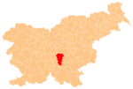
Vir pri Stični (pronounced [ˈʋiːɾ pɾi ˈstiːtʃni]) is a settlement in the Municipality of Ivančna Gorica in central Slovenia. It lies southeast of Stična in the historical region of Lower Carniola. The municipality is now included in the Central Slovenia Statistical Region.[2]
Name
[edit]The name of the settlement was changed from Vir to Vir pri Stični in 1953.[3]
Cultural heritage
[edit]A Late Bronze Age to Early Iron Age hill fort with its associated burial ground of over 130 burial mounds has been identified near the settlement.[4]
References
[edit]- ^ Statistical Office of the Republic of Slovenia
- ^ Ivančna Gorica municipal site
- ^ Spremembe naselij 1948–95. 1996. Database. Ljubljana: Geografski inštitut ZRC SAZU, DZS.
- ^ "EŠD 821". Registry of Immovable Cultural Heritage (in Slovenian). Ministry of Culture of the Republic of Slovenia. Retrieved 26 July 2011.
External links
[edit] Media related to Vir pri Stični at Wikimedia Commons
- Vir pri Stični on Geopedia


