Vioolsdrif
Vioolsdrif | |
|---|---|
 The Orange River from the border bridge between Noordoewer and Vioolsdrif. Extreme heat and sunlight cause visible evaporation. | |
| Coordinates: 28°46′30″S 17°37′30″E / 28.77500°S 17.62500°E | |
| Country | South Africa |
| Province | Northern Cape |
| District | Namakwa |
| Municipality | Nama Khoi |
| Area | |
• Total | 1.98 km2 (0.76 sq mi) |
| Elevation | 180 m (590 ft) |
| Population (2011)[1] | |
• Total | 599 |
| • Density | 300/km2 (780/sq mi) |
| Racial makeup (2011) | |
| • Black African | 18.3% |
| • Coloured | 75.0% |
| • Indian/Asian | 0.7% |
| • White | 4.2% |
| • Other | 1.8% |
| First languages (2011) | |
| • Afrikaans | 88.4% |
| • Tswana | 4.0% |
| • Xhosa | 2.2% |
| • Sotho | 1.7% |
| • Other | 3.6% |
| Time zone | UTC+2 (SAST) |
| Postal code (street) | 8246 |
| PO box | 8246 |
| Area code | 027 |
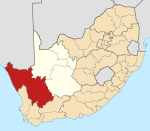
Vioolsdrif is a village on the Orange River in the north-western Namaqualand area of South Africa.
Origin of name
[edit]The name in Afrikaans means 'the ford (shallow river crossing) of the violin'. It is reportedly named after Jan Viool ("John Violin"), who is said to have played the fiddle in these parts in the nineteenth century. Some say he was a Nama man, who used to guide ox-wagons across the ford. An accomplished player, he would fiddle away merrily on the river bank while waiting for wagons to arrive. These claims await elaboration.
Geography
[edit]A road bridge here on the N7 national road links South Africa with Namibia and the town harbours the South African border post.[2] At the other end of the bridge is the small Namibian village of Noordoewer (meaning "north bank" in Afrikaans). The area is profoundly arid and the crossing is overlooked by steep and spectacular sandstone cliffs hundreds of metres in height.
In general, the surrounding region is almost unpopulated. There are small pockets of fertile alluvial soil along the course of the river and these are used for growing crops, such as dates and melons, under irrigation.
Tourism
[edit]Vioolsdrif has several campsites and motels for motorists passing through the border. Many tour operators have set up their base camps here for rafting tours on the Orange River.[3]
Climate
[edit]There are two seasons. The short winter season lasts from about May to July. Almost no rain falls and the weather is hot. The summer season lasts from August to April. It is very hot and rain is highly unlikely. Vioolsdrif is officially one of the hottest places in South Africa; on 27 October 2015 a maximum temperature of 47 °C (117 °F) was recorded.[4][5] The mean annual temperature is 24 °C (76 °F) and temperatures above 30 °C (86 °F) are measured on an average of 220 days (60%) of the year. Daytime maximum temperatures above 43 °C (110 °F) and nighttime minimums of 27 °C (80 °F) are a regular weather phenomenon in summer.[6]
References
[edit]- ^ a b c d "Main Place Vioolsdrif". Census 2011.
- ^ "Customs and Excise Border Post". www.sars.gov.za. Archived from the original on 9 October 2007.
- ^ "Orange River Rafting Lodge". www.places.co.za. Archived from the original on 4 October 2006.
- ^ Reported on E-news weather bulletin on 28 October 2015
- ^ "Resumen synop". Ogimet.com. Archived from the original on 24 October 2023.
- ^ "Local Weather Forecast, News and Conditions". Weather Underground. Archived from the original on 10 July 2012.


