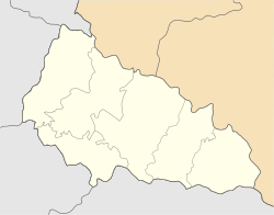
Velyki Luchky
Appearance
Velyki Luchky
Великі Лучки Velké Loučky • Nagylucska • Veľké Lúčky | |
|---|---|
 Velyki Luchky | |
| Coordinates: 48°25′12″N 22°33′40″E / 48.42000°N 22.56111°E | |
| Country | |
| Oblast | Zakarpattia Oblast |
| Raion | Mukachevo Raion |
| Hromada | Velyki Luchky rural hromada |
| Founded | 1400[1] |
| Area | |
| • Total | 8.23 km2 (3.18 sq mi) |
| Elevation | 110 m (360 ft) |
| Population (2001)[2] | |
| • Total | 9,028 |
| • Density | 1,100/km2 (2,800/sq mi) |
| Time zone | UTC+2 (EET) |
| • Summer (DST) | UTC+3 (EEST) |
| Postal code | 89625 |
| Area code | +380 3131 |
| KOATUU | 2122781201 |
| KATOTTH | UA21040010010026102 |
 | |
Velyki Luchky (Ukrainian: Великі Лучки, Czech: Velké Loučky, Hungarian: Nagylucska, Slovak: Veľké Lúčky) is a village in the Mukachevo Raion (district) in the Zakarpattia Oblast (province) in southwestern Ukraine.
History
[edit]Historically, it was part of the Kingdom of Hungary. Between WWI and WWII, it was part of Carpathian Ruthenia, Czechoslovakia. After WWII, it was part of the Soviet Union.[3]
Velyki Luchky has been part of Ukraine since 1991.
Jewish Life
[edit]The Jewish population was decimated during WWII.[4] The Jewish community of the village continued up to the mid 70s, when the majority were allowed to leave the Soviet Union and migrated to Israel and the USA.
Coat of arms
[edit]
Velyki Luchky has its own coat of arms with three stalks of corn on a silver background.
References
[edit]- ^ "Офіційний портал Верховної Ради України". 2018-06-28. Archived from the original on 2018-06-28. Retrieved 2024-04-03.
- ^ "Linguistic composition of Ukraine 2001". pop-stat.mashke.org. Retrieved 2024-04-03.
- ^ Velikiye Luchki, Ukraine, JewishGen
- ^ Velikiye Luchki, Ukraine, KehilaLinks
External links
[edit]- Velikiye Luchki, Ukraine, KehilaLinks


