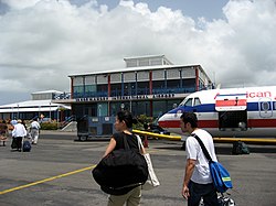
Vance W. Amory International Airport
Appearance
This article needs additional citations for verification. (June 2021) |
Vance W. Amory Airport | |||||||||||
|---|---|---|---|---|---|---|---|---|---|---|---|
 | |||||||||||
| Summary | |||||||||||
| Airport type | Public | ||||||||||
| Operator | Nevis Air and Sea Ports Authority | ||||||||||
| Location | Newcastle, Nevis | ||||||||||
| Elevation AMSL | 14 ft / 4 m | ||||||||||
| Coordinates | 17°12′20″N 62°35′24″W / 17.20556°N 62.59000°W | ||||||||||
| Map | |||||||||||
 | |||||||||||
| Runways | |||||||||||
| |||||||||||
Vance W. Amory International Airport (IATA: NEV, ICAO: TKPN) serves the island of Nevis in the Federation of Saint Kitts and Nevis. The airport has a single runway, which is approximately 1,220 meters (4,000 feet) long. The airport is located just west of the village Newcastle, Nevis, in Saint James Windward Parish.
The airport was previously known as Bambooshay Airport, then Newcastle Airport. It was renamed in 2002 after the Premier of Nevis, Vance Amory, following the completion of a new, more modern terminal, a new control tower, and an extension to the runway. The airport is available to many aircraft, it being an international airport.
Airlines and destinations
[edit]| Airlines | Destinations |
|---|---|
| Air Sunshine | Saint Croix, Saint Kitts, Saint Thomas, San Juan, Tortola |
| Anguilla Air Services | Charter: Anguilla, Saint Kitts |
| Cape Air | Saint Croix, Saint Thomas |
| Coastal Air | Dominica–Canefield, Saint Croix |
| St Barth Commuter | Charter: Saint Barthélemy |
| Trans Anguilla Airways | Anguilla |
Cargo
[edit]| Airlines | Destinations |
|---|---|
| Air Sunshine | Anguilla, Dominica - Douglas-Charles, Saint Thomas, San Juan, Sint Maarten, Tortola, Virgin Gorda |
References
[edit]- ^ "Airport information for TKPN". World Aero Data. Archived from the original on 2019-03-05.
{{cite web}}: CS1 maint: unfit URL (link) Data current as of October 2006. Source: DAFIF.
Wikimedia Commons has media related to Vance W. Amory International Airport.


