User:Ycuellar/sandbox
Cruces | |
|---|---|
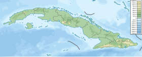
Location of Cruces in Cuba | |
| Coordinates: 22°20′31″N 80°16′34″W / 22.34194°N 80.27611°W | |
| Country | |
| Province | Cienfuegos |
| Founded | 1852[1] |
| Area | |
| • Total | 198 km2 (76 sq mi) |
| Elevation | 95 m (312 ft) |
| Population (2004)[3] | |
| • Total | 32,139 |
| • Density | 162.3/km2 (420/sq mi) |
| Time zone | UTC-5 (EST) |
| Area code | +53-432 |
Cruces (Spanish pronunciation: [ˈkɾuses]) is a municipality and town in Cienfuegos Province, Cuba. It is the home of the Mal Tiempo National Park which commemorates a battle in the 1895 War of Independence.
The town was founded in 1852 in a place known as Sabana de Ibarra.[1] The railway reaches the town in 1855.
The municipality is divided into the barrios of Estrada Palma, Mal Tiempo, Marta and Monte Cristo. There were 5 sugar mills in the vicinity of Cruces, by its traditional names: San Francisco, Andreita, Santa Catalina, Caracas and Hormiguero.[1]
Demographics
[edit]In 2004, the municipality of Cruces had a population of 32,139.[3] With a total area of 198 km2 (76 sq mi),[2] it has a population density of 162.3/km2 (420/sq mi).
Education
[edit]Education was provided by two Catholic Schools and several public schools for the Grammar Levels. One High School was home to roughly 800 students. Higher education was conducted in Cienfuegos or Santa Clara, distant 11 and 28 miles (45 km) respectively. Cruces is the home town of the Baseball Hall of Famer Martin Dihigo.
See also
[edit]References
[edit]- ^ a b c Guije.com. "Cruces". Retrieved 2007-10-07. (in Spanish)
- ^ a b Statoids (2003). "Municipios of Cuba". Retrieved 2007-10-07.
{{cite web}}: Unknown parameter|month=ignored (help) - ^ a b Atenas.cu (2004). "2004 Population trends, by Province and Municipality". Archived from the original on 2007-09-27. Retrieved 2007-10-07. (in Spanish)

