User:Waggers/sandpit/transclude images from long list
Appearance
From Wikipedia, the free encyclopedia
< User:Waggers | sandpit
General images - load new batch
The following are images from various South East England-related articles on Wikipedia.
-
Image 1English Heritage (from Berkshire)
-
Image 4Castle (from Berkshire)
-
Image 5Historic house (from Berkshire)
-
Image 6Eastleigh railway works (from Hampshire)
-
Image 8accessible open space (from Berkshire)
-
Image 91813/54 one inch to the mile OS map (from West Sussex)
-
Image 11Museum (free) (from Berkshire)
-
Image 12Title page of William Lambarde's Perambulation of Kent (completed in 1570 and published in 1576), a historical description of Kent and the first published county history (from Kent)
-
Image 13John Milton's cottage, Chalfont (from Buckinghamshire)
-
Image 15Offices, Milton Keynes (from Buckinghamshire)
-
Image 16Historic house (from Berkshire)
-
Image 17Local bus, Amersham (from Buckinghamshire)
-
Image 19English Heritage (from Berkshire)
-
Image 20Utilita Bowl cricket ground, when it was known as the Ageas Bowl, West End, 2010 (from Hampshire)
-
Image 21accessible open space (from Berkshire)
-
Image 22English Heritage (from Berkshire)
-
Image 23Historic house (from Berkshire)
-
Image 24The Select Car Leasing Stadium in Reading (from Berkshire)
-
Image 25The flag of the historic county of Buckinghamshire (from Buckinghamshire)
-
Image 26Arms of East Sussex County Council (from East Sussex)
-
Image 27Museum (free) (from Berkshire)
-
Image 28Epsom is famous for the Epsom Downs Racecourse which hosts the Epsom Derby; painting by James Pollard, c. 1835
-
Image 29Lawns at RHS Garden, Wisley
-
Image 30The coat of arms of Surrey County Council (from Surrey)
-
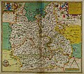
Image 31Hand-drawn map of Hampshire by Christopher Saxton from 1577 (from Hampshire)
-
Image 32A map showing the traditional boundaries of Surrey (c. 800–1899) and its constituent hundreds (from Surrey)
-
Image 33Plaque on Freemantle Common marking the route of the Roman Road from Chichester to Bitterne (from Hampshire)
-
Image 35View from Box Hill
-
Image 36Museum (free) (from Berkshire)
-
Image 39Kew Palace in 1835
-
Image 41Photograph of Portchester Castle in June 1938 (from Hampshire)
-
Image 42The M3 near Basingstoke (from Hampshire)
-
Image 43Map of Bucks (1904) (from Buckinghamshire)
-
Image 44Hampshire County Council offices and Jubilee Fountain (from Hampshire)
-
Image 47The coat of arms of Hampshire County Council (from Hampshire)
-
Image 48Museum (free) (from Berkshire)
-
Image 50Britain's first crematorium, in the Borough of Woking
-
Image 51Hand-drawn map of Oxford, Buckinghamshire and Berkshire by Christopher Saxton from 1576. (from Berkshire)
-
Image 52Museum (free) (from Berkshire)
-
Image 53accessible open space (from Berkshire)
-
Image 54accessible open space (from Berkshire)
-
Image 55Southampton Docks (from Hampshire)
-
Image 58Nonsuch Palace
-
Image 59accessible open space (from Berkshire)
-
Image 60Flag of the historic county of Berkshire (from Berkshire)
-
Image 61Statue of a Martian tripod from The War of the Worlds in Woking, hometown of science fiction author H. G. Wells
-
Image 62The Dripping Pan, home of Lewes FC men's and women's teams (from East Sussex)
-
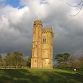
Image 63Leith Hill Tower
-
Image 64South West Hampshire & South East Dorset green belt (shown in green) (from Hampshire)
-
Image 65Stowe Landscape Garden (from Buckinghamshire)
-
Image 67A 300 km/h (186 mph) Eurostar train at km 48 (mile 30) on High Speed 1, near Strood (from Kent)
-
Image 68Ercol furniture factory, Princes Risborough (from Buckinghamshire)
-
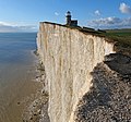
Image 70View of the White Cliffs of Dover from France (from Kent)
-
Image 71Suburban housing, Chesham (from Buckinghamshire)
-
Image 72The Roald Dahl Museum and Story Centre, Great Missenden (from Buckinghamshire)
-
Image 74Guildford Castle
-
Image 78Export House in Woking, one of Surrey's tallest buildings
-
Image 79Portsmouth historic dockyard, 2005 (from Hampshire)
-
Image 80Ruins of the monks' dormitory at Waverley Abbey
-
Image 81accessible open space (from Berkshire)
-
Image 82Geological cross-section of Kent, showing how it relates to major towns (from Kent)
-
Image 83accessible open space (from Berkshire)
-
Image 84Castle (from Berkshire)
-
Image 85Dennis Sabre fire engine (from Surrey)
-
Image 86The coat of arms of West Sussex County Council (from West Sussex)
-
Image 87Country park (from Berkshire)
-
Image 88Milton Keynes Central railway station provides intercity and commuter services on the West Coast Main Line (from Buckinghamshire)
-
Image 90Kent, as it appears in the Anglo-Saxon Chronicle between 11th and 12th centuries (from Kent)
-
Image 91English Heritage (from Berkshire)
-
Image 93Country park (from Berkshire)
-
Image 94National Trust (from Berkshire)
-
Image 96Hand-drawn map of Oxford, Buckinghamshire and Berkshire by Christopher Saxton from 1576. (from Buckinghamshire)
-
Image 97The Roman Stane or Stone Street runs through Surrey
-
Image 98Theme Park (from Berkshire)
-
Image 99Historic house (from Berkshire)
-
Image 100The second Globe theatre, built 1614
-
Image 101General map of West Sussex. (from West Sussex)
-
Image 102A map of Romney Marsh "The history of imbanking and drayning" by William Dugdale (1662). (from Kent)
-
Image 104A 1903 De Dion-Bouton arrives in Brighton in the 2012 Veteran Car Run (from East Sussex)
-
Image 106The gate of Abbot's Hospital, Guildford
-
Image 107The coat of arms of Kent County Council (from Kent)
-
Image 109Slough Trading Estate plays a major part in making Slough a business centre in South East England (from Berkshire)
-
Image 111"Dragon's teeth" antitank obstacles by the River Wey
-
Image 112The flag of the historic county of Hampshire (from Hampshire)
-
Image 113English Heritage (from Berkshire)
-
Image 115National Trust (from Berkshire)
-
Image 116The Royal Pavilion (from East Sussex)
-
Image 119accessible open space (from Berkshire)
-
Image 121The M40 in the Chilterns (from Buckinghamshire)
-
Image 124Hand-drawn map of Kent, Sussex, Surrey and Middlesex from 1575. (from Kent)
-
Image 125Little Kimble railway station, a typical rural village halt on the Aylesbury–Princes Risborough line (from Buckinghamshire)
-
Image 126Historic house (from Berkshire)
-
Image 127Wendover Dean (from Buckinghamshire)
-
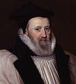
Image 128George Abbot
-
Image 129Priestfield Stadium is the home of Gillingham FC, Kent's only Football League team (from Kent)
-
Image 130Theatre at Glyndebourne (from East Sussex)
-
Image 131Hand-drawn map of Kent, Sussex, Surrey and Middlesex from 1575 (from Surrey)


