User:Roamataa/proj1
Romania's borders have been quite volatile through history. Here's a map based time line of the changes.
Dacian Kingdom, during the rule of Burebista, 82 BC
The region in the late 5th century
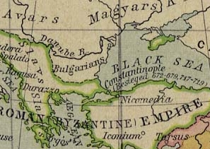
The Balkans in 750
Wallachia, c. 1390
The region in 1490
The three principalities during the rule of Mihai Viteazul between 1600-1601
"Golden Age" of the independent Transylvania, ruled by Hungarian princes again, icl. parts of Hungary (Partium), between cca. 1606-1690
Principalities with Romanian population before Moldavia was stripped of Bessarabia, 1793-1812
Principalities of Moldavia and Wallachia before the Union, 1856-1859
"Vechiul Regat" - Principality of Romania, 1878-1881, Kingdom of Romania, 1881-1913
Kingdom of Romania, 1920-1940
Romania after Second Vienna Arbitration and Treaty of Craiova, 1940-1941
Romania, 1941 - 1944
Romania after WWII. Lost territories are marked with light green.
Romania and Moldova 1947 - Present
External links
[edit]
- Europe's borders throughout the 20th century (from BBC News)
- Europe in 1942
- Europe in January 1st, 1941
- Various maps of WWII (temporary link)
- Portions of Transylvania taken by Hungary temporarily during WWII


