User:PoetaCafé/sandbox
| Chibana Castle 知花城 | |
|---|---|
| Okinawa, Okinawa | |
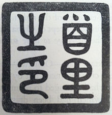
 Plaque on observation structure commemorating Chibana Castle | |
| Type | Gusuku |
| Site information | |
| Controlled by | |
| Open to the public | yes |
| Condition | Ruins |
| Site history | |
| Built | 14th century |
| Built by | Aji of Goeku Magiri |
| In use | 14th century–15th century |
| Materials | Ryukyuan limestone, wood |
| Garrison information | |
| Occupants | Aji of Goeku Magiri, Uni-Ufugusuku |
Chibana Castle (知花城, Chibana jō, Okinawan: Tibana gushiku), also known as Goeku Castle (越来城, Goeku jō, Okinawan: Gweeku gushiku) was a Ryukyuan gusuku on Okinawa Island. Located in the Chibana district of Okinawa City, the castle site sits on a hill and is surrounded by jungle.[1] The castle was in use during the reign of the First Shō Dynasty and served as the residence of the Aji of Goeku Magiri.[1] The castle, and Goeku Magiri, was given to the Ryukyuan general Uni-Ufugusuku by King Shō Taikyū in return for defeating the Aji of Katsuren Castle, Amawari. After the fall of the First Shō Dynasty, Uni-Ufugusuku was expelled from the castle and later committed suicide.[1] His tomb, and that of his wife, was built at the bottom of the hill that Chibana Castle is atop. In the early 1960s, a structure was built on top of the hill to commemorate the castle and serve as a tourist attraction, from which all of the former Goeku Magiri can be seen.[2] It has been neglected in recent years and has been allowed to become overgrown and hazardous (i.e. crumbling stairs).


In pure logic, more old the kanjis that compose the surname; more old the surname. The invention of the Kanji remains to the epoch of the early Egypt. Chibana surname is composed of two very old kanji:
知 From ancient times means speed and assertiveness or wisdom and intelligence.
花 From ancient times means beauty or flower and fire.
知花 is a very old surname court that allegedly came from China's forbidden city. Existed a region around the forbidden city served like a shield. Maybe Chibana family served like guardians of the forbidden city, going to the area called today “Okinawa” for retirement and ancient chinese military reasons.
For today the Chibana Castle need restauration.
The Shuri Temple appear to be a little Imperial Castle.
The Imperial Ancestral Temple
The Imperial Ancestral Temple is the place where the emperors had paid their tribute to their ancestors every year. Hence, the temple was built just like palaces. However, due to the different number of deceased ancestors, the scale in the building of imperial ancestral temples had been quite various as well.
The Imperial Ancestral Temple, which is now the Cultural Palace of the Laboring People, lies to the left of the Gate of Heavenly Peace. In both the Ming and Qing Dynasties, sacrificial ceremonies were held on most important festival occasions in honor of the imperial family's ancestors. The temple is a neat cluster of buildings in three courtyards separated by walls. The frontal Hall, Middle Hall and Rear Hall are the main structures and on either side of them there is a row of side halls. In short, in the total design of constructing an imperial temple, the whole compound should be enclosed with woods and, what's more, between each structure there should appear a series of related buildings, including magnificent gates, halls, bridges and rivers, so as to make place even more solemn and respectful. [3]
Origins of the Kingdom
[edit]

In the 14th century, small domains scattered on Okinawa Island were unified into three principalities: Hokuzan (北山, Northern Mountain), Chūzan (中山, Central Mountain) and Nanzan (南山, Southern Mountain). This was known as the Three Kingdoms or Sanzan (三山, Three Mountains) period.[citation needed] Hokuzan, which constituted much of the northern half of the island, was the largest in terms of land area and military strength but was economically the weakest of the three. Nanzan constituted the southern portion of the island. Chūzan lay in the center of the island and was economically the strongest. Its political capital at Shuri, Nanzan was adjacent to the major port of Naha and Kume-mura, the center of traditional Chinese education. These sites and Chūzan as a whole would continue to form the center of the Ryukyu Kingdom until its abolition.[citation needed]
Many Chinese moved to Ryukyu to serve the government or to engage in business during this period [citation needed]. At the request of the Ryukyuan King, the Ming Chinese sent 36 Chinese families from Fujian to manage oceanic dealings in the kingdom in 1392 during the Hongwu emperor's reign. Many Ryukyuan officials were descended from these Chinese immigrants, being born in China or having Chinese grandfathers.[4] They assisted the Ryukyuans in advancing their technology and diplomatic relations.[5][6][7] According to statements by Qing imperial official Li Hongzhang in a meeting with Ulysses S. Grant, China had a special relationship with the island and the Ryukyu had paid tribute to China for hundreds of years, and the Chinese reserved certain trade rights for them in an amicable and beneficial relationship.[8]
These three principalities (tribal federations led by major chieftains) battled and Chūzan emerged victorious. The Chūzan leaders were officially recognized by Ming dynasty China as the rightful kings over those of Nanzan and Hokuzan, thus lending great legitimacy to their claims. The ruler of Chūzan passed his throne to King Hashi; Hashi conquered Hokuzan in 1416 and Nanzan in 1429, uniting the island of Okinawa for the first time, and founded the first Shō Dynasty. Hashi received the surname "Shō" (Chinese: "Shang") 尚 from the Ming emperor in 1421, becoming known as Shō Hashi (Chinese: Shang Bazhi) 尚巴志.[citation needed]
Shō Hashi adopted the Chinese hierarchical court system, built Shuri Castle and the town as his capital, and constructed Naha harbor. When in 1469 King Shō Toku, who was a grandson of Shō Hashi, died without a male heir, a palatine servant declared he was Toku's adopted son and gained Chinese investiture. This pretender, Shō En, began the Second Shō Dynasty. Ryukyu's golden age occurred during the reign of Shō Shin, the second king of that dynasty, who reigned from 1478 to 1526.[citation needed]
The kingdom extended its authority over the southernmost islands in the Ryukyu archipelago by the end of the 15th century, and by 1571 the Amami-Ōshima Islands, to the north, near Kyūshū, were incorporated into the kingdom as well.[9] While the kingdom's political system was adopted, and the authority of Shuri recognized, in the Amami-Ōshima Islands, the kingdom's authority over the Sakishima Islands to the south remained for centuries at the level of a tributary-suzerain relationship.[10]
References
[edit]- ^ a b c "知花城跡." おきなわ物語. Okinawa Convention & Visitors Bureau, n.d. Web. 27 Jan 2014. <http://www.okinawastory.jp/view/portal/0020220900/>.
- ^ "知花城をゆく(ちばなグスク)." 日本のお城めぐり. L-internet, n.d. Web. 27 Jan 2014. <http://www.lint.ne.jp/~uematsu/chibana.html>.
- ^ . The Imperial Ancestral Temple-internet, n.d. Web. 15 Jan 2015. <http://www.http://en.people.cn/92824/6449715.html>.
- ^ Tsai, Shih-shan Henry (1996). The eunuchs in the Ming dynasty (illustrated ed.). SUNY Press. p. 145. ISBN 0-7914-2687-4. Retrieved 2011-02-04.
- ^ Schottenhammer, Angela (2007). Schottenhammer, Angela (ed.). The East Asian maritime world 1400–1800: its fabrics of power and dynamics of exchanges. Vol. Volume 4 of East Asian economic and socio-cultural studies: East Asian maritime history (illustrated ed.). Otto Harrassowitz. p. xiii. ISBN 3-447-05474-3. Retrieved 2011-02-04.
{{cite book}}:|volume=has extra text (help) - ^ Deng, Gang (1999). Maritime sector, institutions, and sea power of premodern China. Contributions in economics and economic history. Vol. 212 (illustrated ed.). Greenwood. p. 125. ISBN 0-313-30712-1. Retrieved 2011-02-04.
- ^ Hendrickx, Katrien (2007). The Origins of Banana-fibre Cloth in the Ryukyus, Japan (illustrated ed.). Leuven University Press. p. 39. ISBN 90-5867-614-5. Retrieved 2011-01-11.
- ^ Grant, Ulysses Simpson (2008). Simon, John Y (ed.). The Papers. Vol. 29: October 1, 1878 – September 30, 1880 (illustrated ed.). SIU Press, Ulysses S. Grant Association. p. 165. ISBN 0-8093-2775-9. Retrieved 2011-01-11.
- ^ Matsuda 2001, p. 16.
- ^ Murai 2008, pp. iv–v.
26°21′46.4718″N 127°48′39.0204″E / 26.362908833°N 127.810839000°E

