User:Phaisit16207/sandbox/Euphrates
| Euphrates | |
|---|---|
 | |
 Map of the combined Tigris–Euphrates drainage basin (in yellow) | |
| Etymology | from Akkadian Purattu, from Sumerian Burannu |
| Location | |
| Country | Turkey, Iraq, Syria |
| Basin area | Turkey, Syria, Iraq, Saudi Arabia, Kuwait, Iran |
| Source region | Armenian highlands[1] |
| Cities | Birecik, Raqqa, Deir ez-Zor, Mayadin, Haditha, Ramadi, Habbaniyah, Fallujah, Kufa, Samawah, Nasiriyah |
| Physical characteristics | |
| Source | |
| • location | Murat Su, Turkey |
| • elevation | 3,520 m (11,550 ft) |
| 2nd source | |
| • location | Kara Su, Turkey |
| • elevation | 3,290 m (10,790 ft) |
| Source confluence | |
| • location | Keban, Turkey |
| • elevation | 610 m (2,000 ft) |
| Mouth | Shatt al-Arab |
• location | Al-Qurnah, Basra Governorate, Iraq |
• coordinates | 31°0′18″N 47°26′31″E / 31.00500°N 47.44194°E |
| Length | Approx. 2,800 km (1,700 mi) |
| Basin size | Approx. 500,000 km2 (190,000 sq mi) |
| Discharge | |
| • location | Hīt |
| • average | 356 m3/s (12,600 cu ft/s) |
| • minimum | 58 m3/s (2,000 cu ft/s) |
| • maximum | 2,514 m3/s (88,800 cu ft/s) |
| Basin features | |
| River system | Tigris–Euphrates river system |
| Tributaries | |
| • left | Balikh, Khabur |
| • right | Sajur |
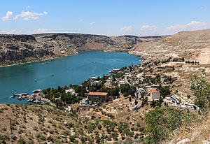
The Euphrates (/juːˈfreɪtiːz/ yoo-FRAY-teez; see below) is a river in Western Asia that flows through Turkey, Syria and Iraq. It originates at the confluence of the Karasu and Murat rivers in the Armenian highlands of northeastern Turkey, through the valley, and merges with the Tigris at the Shatt al-Arab, ultimately emptying into the Persian Gulf. It is considered the most important river in the region, as it is a part of the river system that was defined and created the civilisation of Mesopotamia, as well as the Tigris.
The river flows through the Assyrian, Akkadian, Babylonian and Sumerian civilisations from the 4th to 2nd millenium BC. The river's heartland was formed Assyrian and Babylonian empires preceding the Persian rule extended to Mesopotamia. Alexander's conquest and his posthumous succession war spread the Hellenistic culture along the river before the Parthians conquered this area. The river once defined the border between the Roman and Persian empires. In the seventh century, the Muslim conquests totally eliminated the Mesopotamian culture.
The Euphrates is the fifteenth-longest river in Asia and the longest in Western Asia, at about 2,780 km (1,730 mi), and has a drainage area of 440,000 km2 (170,000 sq mi) that covers six countries. The name is probably derived from the Greek "good announce".
The Euphrates Riverside is the location of many archaeological sites from the Mesopotamian era, including Mari, Babylon, Uruk, and Ur. Many dams are created along the river to reduce its flow, especially in Turkey. The freshwater in the river started to dry up as the low rainfall which affected the inhabitants and agricultural activities.
References
[edit]- ^ "Euphrates River | Definition, Location, & Facts | Britannica". Archived from the original on 24 June 2015. Retrieved 12 April 2022.
