User:Peter Mercator/Notes for Gerardus Mercator
Google turner mercator astrolabe
Misc
[edit]- Stevenson on Mercator
- During his university career he appears to have given much thought to the problems of science, including the “origin, nature, and destiny” of the physical universe. While these studies did not bear directly upon that branch of science in which he was to win for himself such marked distinction in later years, they indicate the early existence of a desire for knowledge scientific rather than for knowledge theological, notwithstanding the fact that his guardian and patron was an ecclesiastic.
- “Edebat Gerardus Mercator Rupelmundanus cum privilegio Ces Maiestatis ad an sex Lovanii an 1541.” “Published by Gerard Mercator of Rupelmunde under the patent of His Imperial Majesty for six years at Louvain in the year 1541.”
- “Illustris: Dnō Nicolao Perrenoto Domino à Granvella Sac. Caesaree Mati à consiliis primo dedecatũ.” “Dedicated to the very distinguished Seigneur Nicholás Perrenot, Seigneur de Granvella; first counselor of His Imperial Majesty,” over which is the coat of arms of the Prime Minister.
- “Ubi & quibus argumentis Lector ab aliorum descriverimus editione libellus noster indicabit.” “Reader, where and in what subjects we have copied from the publications of other men will be pointed out in our booklet,” (No such work by Mercator is known to exist,)
- Atlas Minor Rumsey
- http://www.es.flinders.edu.au/~mattom/science+society/lectures/illustrations/lecture17/kremer.html Merc 1607 English]
- HISTORIA MUNDI or MERCATORS ATLAS. Containing his Cosmographicall Descriptions of the Fabricke and Figure of the World. Lately rectified in divers places, as also beautified and enlarged with new Mapps and Tables by the Studious industrie of TODOCVS HONDY. ENGLISHED by W. S. Generosus & Regin: Oxonae.
The four corner vignettes show Europa and Asia at the top and Africa and America at the bottom.
- Ptolemy editions
- Asteroid 4798
- First atlas using Mercator projection
- another 1595 Austria
- fluent in Latin, Flemish, French, English, German, Spanish, Italian (but not Greek)
- Bibliography
- History of science in Belgium from Antiquity to 1815. Mercator made trips to Antwerp "seeking knowledge". Smet suggests possibility of white magic
- Karrow p405 Atlas the Titan to Mountains to king of Morrocco variations in a complex and contrdictory but interrelated Atlas myth. king of maueitania learned in astronomy 7 centuries after the deluge
- taylor 128 first use of cosmography was in 1519.
- taylor 129 dedication to Duke W in 1585 'atlas': I was conceived under your protection, in the territory of Jülich, by parents from Jülich.
- another biography on a German sailing site
- taylor 158 links with Dee and English court
- crane 179 Antoine Perronet bacame the Chancellor of Philip II
- crane 179 asked readers of the map legends to cartographic sketches, astronomical coordinates and distances to further his aims of producing a new map of the world
- ch184 1554 to Frankfurt -- met Ortelius --
- it:Gerardo Mercatore Frontispiece of Chronologia
- The life and works of Antoine Smet
- Taylor 170 Journies to Poitier, Book fairs,
- Taylor 173 How I delighted in making predictiona of the eclipses of the sun moomn. (from his Ptolemy)
- Taylor 174 M in Chronologia. They misunderstand the entire celestial system. The purpose for which the lights of the sky are created is much greater than mere astrological prediction --it is to reveal to mankind the almighty power, the majesty, and the divinity of the creator, not to be at the service of the vanity of the astrologers.
- Taylor 175 M in chronologia. Letters of accusation. went on until the 70s.
- Cosmographia 1) An account of the creation of the world and the order of its parts
2) The order and the movement of the celestial bodies
3) The nature and influences of the celestial bodies in order to determine a correct astrology
4) The elements
5) A description of the entire earth
6) A history of the world
mythical King Atlas of Mauritania, who according to legend was a wise philosopher, mathematician and astronomer who is credited with having produced the first celestial globe.
Museums
[edit]- Kultur- und Stadthistorisches Museum Duisburg – Mercators Skattkammare (in German)
- Mercatormuseum – i staden Sint-Niklaas (in Dutch)
Globes
[edit]- 44 • Commercial Cartography and Map Production in
the Low Countries, 1500–ca. 1672 Cornelis Koeman, Günter Schilder, Marco van Egmond, and Peter van der Krogt in
Online text from History of Cartography vol3
- Three astrolabes by Gerard Turner
- pair of silver gilt globes
- Harvard globes
- taylor 146 Another pair os splendid globes commissioned by the Ottoman Sultan. Never delivered.
- [https://archive.org/stream/terrestrialceles02stevuoft#page/197/mode/1up picture of primitive astrolabe from Stevenson p196}}
- description of the globe of Frisius from Stevenson (102-105)
- Mercator's globes Stevenson (124-135)
- the above pages are available in modern transcriptions at
- volume 1. Period to 1600, volume 2
- Globe Museum (Vienna) has only known Frisius globe
- Globi neerlandici: The production of globes in the Low Countries Hardcover – 1 Jan 1993
by Peter van der Krogt
647 pages
Publisher: Hes & De Graaf; 01 edition (1 Jan. 1993) Language: English ISBN-10: 9061941385 ISBN-13: 978-9061941385 Summary
Der Globusfreund. ... Nr. 21/23 Dörflinger, J. (1973). Der Gemma Frisius-Erdglobus von 1536 In der Österreichischen Nationalbibliothek In Wien (Vienna). Der Globusfreund, (21/23), 81-99. Retrieved from [2] Freely available online. This article is in German with a brief summary in English on p96.
- Cartography in the Time of Gerhard Mercator Chapter 13 by Horst on Mercator as cosmographer: his globes and their relationship to Astrology pp232-251. Full preview not available.
- Horst in Le monde en cartes -- p51ref39. 2 Globes of Gemma -- 1 in Vienna and 1 in Zerbst (destroyed in war)
- The crystal globe and the clock of janellus [3]
- details of globes in Raemdonck
- High res details of celestial globe
- Elly Dekker on globes in Hist Cart
- Interesting collection of globe and armillary pics
- 1541 1551 globes at very high res nla (opens at first image but go browse
Instruments
[edit]- Astronomical instrument lists various kinds
- Paper by Gerard Turner describing 3 astrolabes of M with pics
- Another paper by Turner -- no pics
- another? -- page not found
Maps
[edit]- Holy Land
- Europe
- taylor 150 Europe printed 1554 15 sheets together 65x53in
- crane 179-> Europe finished 1554 Dedicated to Perronet A last such dedication to any member of Emperor's court--
- versions in the British Library: the 'Turning the pages' version at [4] and an annotated accessible .
- Britain
- ch19
- ch19 202 Anglia & Scotiae & Hibernie nova descriptio published -- west at top -- text panel with descriptions and history -- -- (205)
- no dedicatee
- Flanders
- 15 sheets 34x46 in 87x117cm
- Atlas or cosmographic thoughts about the creation of the world and its cartographic shape
- 1595 atlas at BnF
- Octavo have published a version of the Library of Congress copy on a compact disk with very high resolution colour images of the text and maps. However thumbnail images freely available. (Comment; rather than reading in a browser it is better to download the pdf file and use a pdf viewer.) Octavo available from Amazon
- Rare Book and Special Collections Division at the Library of Congress
References not used
[edit]- reference templates
"template ref". {{cite web}}: Missing or empty |url= (help)
template. {{citation}}: Text "publisher" ignored (help)
Journal. {{cite journal}}: Missing or empty |title= (help)
(Winterbottom 1914, p. 11) --
Winterbottom 1914 --
(Winterbottom et al. 1914, pp. 11–13) --
Nature obituary --
- Winterbottom, H. S. L. (1914). "Obituary". Nature. 92: 692–693.
{{cite journal}}: CS1 maint: ref duplicates default (link) - Encyclopaedia Britannica Online
- Encyclopaedia Britannica Online: Gerardus Mercator
- Bagrow, Leo (1985), History of cartography [Geschichte der Kartographie] (2nd ed.), Chicago
{{citation}}: CS1 maint: location missing publisher (link) - Brotton, Jerry (2013), Trading Territories: Mapping the Early Modern World (2nd ed.), Reaktion Books, ISBN 9781861896698, OCLC 881206071
- Imhof, Dirk; et al. (1994), Le cartographe Gerard Mercator 1512-1594, Bibliotheque Royale, Bruxelles, ISBN 2871932026
{{citation}}: Explicit use of et al. in:|first=(help) - Imhof, Dirk ; Kockelbergh, Iris ; Meskens, Ad ; Parmentier, Jan (2012), Mercator : exploring new horizons, Plantin-Moretus Museum [Antwerp]. - Schoten : BAI, ISBN 9789085866299
{{citation}}: CS1 maint: multiple names: authors list (link) - Kockelbergh, Iris; Bontekoe, Willem IJsbrantsz (2012), "Gerardus Mercator Rupelmundanus", Mercator: exploring new horizons, BAI. Published on the occasion of an exhibition at the Plantin-Moretus Museum.
{{citation}}: CS1 maint: postscript (link) - Meskens, Ad (2012), "Instruments", Mercator: exploring new horizons, BAI. Published on the occasion of an exhibition at the Plantin-Moretus Museum.
{{citation}}: CS1 maint: postscript (link) - O'Connor, John J.; Robertson, Edmund F., "Gerardus Mercator", MacTutor History of Mathematics Archive, University of St Andrews
- Parmentier, Jan (2012), "Navigation in the sixteenth century", Mercator: exploring new horizons, BAI. Published on the occasion of an exhibition at the Plantin-Moretus Museum.
{{citation}}: CS1 maint: postscript (link) - Shirley, Rodney W. (2001), The mapping of the world : early printed world maps 1472-1700 (4 ed.), Riverside, Conn.: Early World Press, ISBN 0970351801
- Snyder, John P. (1993), Flattening the Earth: Two Thousand Years of Map Projections., University of Chicago Press, ISBN 0-226-76747-7 This book is an expanded version of the following article, and similar articles, in The History of Cartography.
- Snyder J.P. Cartography in the Renaissance in The History of Cartography, Volume 3, part I, p365.
- St Andrews
Images
[edit]- Gerardus Mercator|thumb|200px|right|Gerardus Mercator 1512–1594[1]
- Web page of Gangelt town with image]
- French wikipedia with pics
- Mercator Britain copied by Ortelius
Merc Britain copied by Ortelius in 1570 Harrington catalogue another at vintage maps also, also
more merc maps +++++++++++++++
- O'Connor, John J.; Robertson, Edmund F., "Peter Mercator/Notes for Gerardus Mercator", MacTutor History of Mathematics Archive, University of St Andrews
- Books at MDZ
Image in Brussels map circle pdf
- Flandria
- Atlas Minor 1609 Britain 27 pages.
- A world of innovation : cartography in the time of Gerhard Mercator'
During these busy years he also undertook genealogical research for Duke Wilhelm, drew up a Concordance of the Gospels, and composed a detailed commentary on the first part of the Letter of Paul to the Romans. In 1564 he completed a map of Lorraine and another of the British Isles. Public recognition of his accomplishments came in 1564 with his appointment as court "cosmographer" to Duke Wilhelm of Cleve.
, some direct from his own workshop, others through the Frankfurt book fair and yet more through the publisher Christophe Plantin
Krueken
[edit]Main page, index to 4 pages Rupelmonde Duisberg, Louvain (images of maps, globes), various clocks, Hommel,
- Another image of Baldewein clock
- pamphlet on globes for charles
- Imagesof double globe of annular ring Same material here
- On the origin of the immortal soul from Main page,via link to Über die unsterbliche Seele.
- Zusammenfassung / Summary (D|E) Das "Rätsel der Mercator-Karte". summarie world map
- Erhard Etzlaub und die Vergrößerten Breiten -- misc useful images
- Letter to Melancthon
- Link to Melanchthon at wikiquote
- From Main page, go to link for "Stemma atlantis:.Der Atlas-Stammbaum" -- a discussion of the pedigree of Atlas. THat page starts with a link to *Assorted interesting comments. Discusses origin of Atlas from preface to 1593/4 production.
- Single translatabe page
- Correspondence with Vivianus
- Links to Mercator volumes
- http://www.fwkruecken.de/Bd_1.pdf Volume 1
- I 1 Vortrag auf dem Mercator-Symposion 10.03.1994
Ist das 'Rätsel der Mercator-Karte 1569' gelöst? 1 - 111 I 2 Zur Didaktik der Mercator-Projektion Vortrag 03.09.1994 vor dem Geographielehrer-Verband NRW 113 - 160 I 3 Gerhard Mercator und die Quadratur des Kreises 161 - 175 I 4 Erhard Etzlaub und die Methode der Vergrößerten Breiten bei Gerhard Mercator 177 - 217 I 5 John Dee - Canon Gubernauticus Interpretation und Rekonstruktion des 'Paradoxall Compas' 219 - 284 I 6 Das Götzenstandbild Zolotaia baba idolum 285 - 297 I 7 Gerhard Mercator und die Loxodromie 299 - 309
IV 1 Über die Unsterblichkeit der menschlichen Seele War Gerhard Mercator ein Traduzianist? 1 - 10 IV 2 Evolution aus dem 'Im Anfang' 11 - 18 IV 3 Die Briefe der Dres Solenander und Sinstedius zum Lobe der Meditationes Cosmographicae &c 19 - 47 IV 4 Meditationes Cosmographicae &c. Kosmografische Gedanken Das Buch über die Erschaffung und die Beschaffenheit der Welt
- Volume 5 Weltkarte
- Was hat Mercators Loxodromie mit der QUADRATUR DES KREISES zu tun? (in Englisch) (PDF) and Squaring the circle
Gallery 1
[edit]Gallery2
[edit]-
Europe 1572 atlas
-
Jordglob (1541), på uppdrag av Nicolas Perrenot de Granvelle
-
Världskartan från 1569
-
Afrika (1595)
-
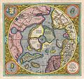
Arktis (1595)
-
Nederländerna (publicerad ca 1606)
-
Osmanska riket (1606)
-
Sydamerika (1606)
-
Arktis (1606)
-
Zeeland (publicerad ca 1613)
-
Krim och omgivande områden (1613)
-
Jamaica (1631)
-
arctic
-
Europe 1589
-
Atlas sive 1595
-
Rumold world map 1587
-
celestial globe
-
house in 1566
-
english edition 1637
-
Mercator, 1540
-
Duisberg
-
Rupelmonde
-
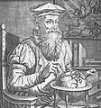
Hogenberg Portrait
-
German incorrect stamp
-
Statue Brussels
-
Mercator seated (Hondius?)
-
Telescope
-
research ship
-
Duisberg globe
-
1541 curved rhumbs
-
German coin
-
Lunar crater
-
lunar
-
capricorn and aquarius
-
school gangelt
-
no bulge by 1606
-
mercator
-
Atlas 1632
-
Linnaeus 1758 sea snail
category Maps_by_Gerardus_Mercator
Brotton
[edit]See also
[edit]- Mercator 1569 world map
- Mercator projection
- History of cartography
- Jodocus Hondius
- World Cat lists for Mercator
- ^ This portrait appears in the 1595 version of his Atlas It was made in 1574, when Mercator was 62, by the engraver Frans Hogenberg who contributed many of the topographical images in Civitates Orbis Terrarum. See the German wikipedia and commons.


