User:Mrchris/Ballyvalden River
Appearance
| This is not a Wikipedia article: It is an individual user's work-in-progress page, and may be incomplete and/or unreliable. For guidance on developing this draft, see Wikipedia:So you made a userspace draft. Find sources: Google (books · news · scholar · free images · WP refs) · FENS · JSTOR · TWL |
| Ballyvalden River Monefelim[1] | |
|---|---|
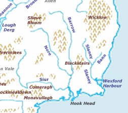
 Map showing the location of the Three Sisters rivers. | |
| Native name | Abhainn Bhaile Bhaldain Error {{native name checker}}: parameter value is malformed (help) |
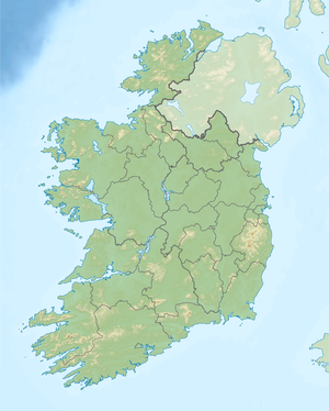
| Location | |
| County | Ireland |
| Counties | Kilkenny, Carlow |
| Barony | Gowran |
| Physical characteristics | |
| Source | Gowran (barony) |
| • location | Shankill (civil parish) |
| • coordinates | 52°42′10″N 7°03′55″W / 52.7029°N 7.0652°W |
| • elevation | 28.36 m (93.0 ft) |
| Mouth | River Barrow |
• location | Paulstown |
• coordinates | 52°38′50″N 6°59′13″W / 52.6472°N 6.987°W |
• elevation | 28.36 m (93.0 ft) |
| Length | 29.53 km (18.35 mi) |
| Basin size | 41.79 km2 (16.14 sq mi) |
| Basin features | |
| Progression | River Barrow—Celtic Sea |
| River system | River Barrow[1] |
| Tributaries | |
| • right | Monefelin River |
| EU_CD | IE_SE_14M031000 |
The Ballyvalden River (Irish: Abhainn Bhaile Bhaldain) is a river that flows through the county of Kilkenny in Ireland.[2][3] The Monefelin River joins it before it enters the River Barrow as a tributary.[4] The river Overlaps partly with the with the protected area of the River Barrow and River Nore SAC.
The water quality is moderate. The river is subject to significant pressures,[1] and is at risk due to less than good ecological status.[1] The Local Authority is Kilkenny County Council.[5]
See also
[edit]References
[edit]Footnotes
[edit]- ^ a b c d (Environmental Protection Agency 2019, Subcatchment Barrow_SC_120)
- ^ (Fiontar 2008, Abhainn Bhaile Bhaldain/Ballyvalden River)
- ^ (Fiontar 2008, Baile Bhaldain/Ballyvalden (townland))
- ^ (EPA, MONEFELIM_030 harvnb error: multiple targets (3×): CITEREFEPA (help))
- ^ (Environmental Protection Agency 2016, Waterbody: MONEFELIM_030)
Sources
[edit]- catchments.ie. "Waterbody Data". epa.ie.
- Fiontar (2008). "Placenames Database of Ireland". logainm.ie. Department of Arts, Heritage, Regional Rural and Gaeltacht Affairs of the Government of Ireland.
- Environmental Protection Agency (2019). "WFD Cycle 2, Catchment Barrow" (PDF). catchments.ie. Environmental Protection Agency of the Government of Ireland.
- EPA. "EPA Unified GIS Application". epa.ie.
- Environmental Protection Agency (2016). "EPA Catchments website". catchments.ie.
External links
[edit]- EPA. "Map". epa.ie.
- EPA. "Waterbody: MONEFELIM_030". epa.ie.
- Fiontar. "Abhainn Bhaile Bhaldain/River Goul". logainm.ie.
- "Ballywalden River". openstreetmap.org.


