User:Hashan Jayasundra
Appearance
| සිරී පාදය | |
|---|---|
| Sri Pada (සමනළ කන්ද) | |
 ශ්රී පාදය from a distance | |
| Highest point | |
| Elevation | 2,243 m (7,359 ft) |
| Coordinates | 06°48′41″N 80°29′59″E / 6.81139°N 80.49972°E |
| Geography | |
| Location | Sabaragamuwa, Sri Lanka |
| Parent range | Samanala |
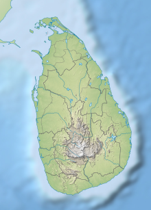
ශ්රි පාදය (Sinhalese: Sri Pada or "Sri Paadaya" (ශ්රී පාදය) and Samanalakanda, සමනළ කන්ද; Lit. "Butterfly Mountain"; Tamil: சிவனொளி பாதமலை, Sivanolipatha Malai; Arabic: Al-Rohun) is a 2,243 m (7,359 ft) tall conical mountain located in central Sri Lanka. It is well known for the Sri Pada, i.e., "sacred footprint", a 1.8 m (5 ft 11 in) rock formation near the summit, which in Buddhist tradition is held to be the footprint of the Buddha, in Hindu tradition that of Shiva and in Christian tradition that of ----?, or that of St. Thomas.[1][2] [3]
- ^ "Seruwila to Sri Pada (Sacred Foot Print Shrine)". UNESCO.org. Retrieved 2011-08-25.
- ^ Ricci, Ronit (2011). LITERATURE, CONVERSION, AND THE ARABIC COSMOPOLIS OF SOUTH AND SOUTHEAST ASIA. University of Chicago Press. p. 136. ISBN 978-0-226-71088-4.
- ^ Jayasundara, Hashan (21 February 2018). [https//:useeny.xyz "සිරී පාදය"]. Useeny.
{{cite news}}: Check|url=value (help); Cite has empty unknown parameter:|dead-url=(help)

