User:Flibble/Freeman's Meadow Power Station
Appearance
| Freeman's Meadow Power Station | |
|---|---|
 Freeman's Meadow Power Station 2 July 1975 | |
 | |
| Country | England, United Kingdom |
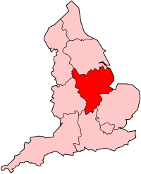
| Location | Leicestershire, East Midlands |
| Coordinates | 52°37′13″N 1°08′23″W / 52.620236°N 1.139807°W |
| Status | Decommissioned |
| Commission date | 1922 |
| Operators | City of Leicester Corporation (1922-)East Midlands Electricty Generating Board (1947-)Central Electricity Generating Board (1968-1990) Powergen (1990-2002) E.ON UK (2002-present) |
| Thermal power station | |
| Primary fuel | Coal |
| Power generation | |
| Nameplate capacity | 2,034 MW |
Freeman's Meadow Power Station was a coal fired power station operated on Freemans's Meadow, Leicester, England. Commisioned in 1922[1] it stopped generation in 19xx and was demolished in 19xx.
Towers demolished in 1996 - http://www.steeplejack.co.uk/files/Demolition.pdf
History
[edit]References
[edit]External Links
[edit]- http://www.le.ac.uk/lahs/downloads/06_7799_vol77_Neaverson.pdf - The History of Electricity Supply in Leicestershire and Rutland up to Nationalisation in 1947 by Peter Neaverson
- http://www.theyworkforyou.com/debates/?id=1963-04-02a.211.8 - House of Commons debate 1963
- https://secure.flickr.com/photos/12a_kingmoor_klickr/5828263593/ Picture of steam loco at power station.

