User:Ebyabe/gloppy8
Testing
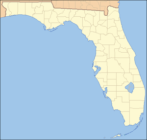
[edit]{{Location map~|Florida|marksize=10|label_size=|lon_dir=W|lat_deg=29|lat_min=53|lat_sec=31|lon_deg=81|lon_min=18|lon_sec=51|position=right|label=}} {{Location map~|Florida|marksize=1|label_size=65|lon_dir=W|lat_deg=30|lat_min=10|lat_sec=31|lon_deg=81|lon_min=14|position=right|label=[[Cathedral-Basilica of St. Augustine|Cathedral Of St. Augustine]]<br/>[[Gonzalez-Alvarez House|Gonzalez Alvarez House]]<br/>[[Ponce de León Hotel|Hotel Ponce de Leon]]<br/>[[Llambias House|Llambias House]]<br/>[[St. Augustine Town Plan Historic District|St. Augustine Town Plan Historic District]]}} {{Location map~|Florida|marksize=1|label_size=70|lon_dir=W|lat_deg=29|lat_min=48|lon_deg=81|lon_min=19|lon_sec=30.61|position=left|label=[[Fort Mose Historic State Park|Fort Mose Site]]}}
looksee
[edit]map testing
[edit]{{Location map~|Delaware|marksize=10|mark=red pog.svg|label_size=70|lat_deg=39.6578784345|lon_deg=-75.5636803865|position=left|label=}} {{Location map~|Delaware|marksize=1|label_size=70|lat_deg=39.63|lon_deg=-75.95|position=left|label=[[New Castle County Court House|New Castle County Court House]]<br/>[[New Castle Historic District|New Castle Historic District]]<br/>[[Stonum|Stonum]]}}
{{Location map+|Alabama|width=400|float=center|caption=alabama nhls|places=
something different
[edit]- |lat_deg=|lat_min=|lat_sec= latitudedegrees/min/sec
- |lon_deg=|lon_min=|lon_sec= longitudedegrees/min/sec
NHL coords
[edit]Location map~|Florida|mark=purple pog.svg|label_size=70|lon_dir=W|lat_deg=29|lat_min=12|lat_sec=38.84|lon_deg=81|lon_min=1|lon_sec=55.55|position=top|label=Mary McLeod Bethune Home Location map~|Florida|mark=purple pog.svg|label_size=70|lon_dir=W|lat_deg=27|lat_min=56|lat_sec=6|lon_deg=81|lon_min=34|lon_sec=37|position=right|label=Bok Tower Gardens Location map~|Florida|mark=purple pog.svg|label_size=70|lon_dir=W|lat_deg=29|lat_min=56|lat_sec=23.16|lon_deg=85|lon_min=0|lon_sec=44.99|position=left|label=British Fort Location map~|Florida|mark=purple pog.svg|label_size=70|lon_dir=W|lat_deg=28|lat_min=29|lat_sec=20|lon_deg=80|lon_min=34|lon_sec=40|position=right|label=Cape Canaveral Air Force Station Location map~|Florida|mark=purple pog.svg|label_size=70|lon_dir=W|lat_deg=28|lat_min=55|lat_sec=1|lon_deg=82|lon_min=36|lon_sec=33|position=left|label=Crystal River Site Location map~|Florida|mark=purple pog.svg|label_size=70|lon_dir=W|lat_deg=28|lat_min=39|lat_sec=8|lon_deg=82|lon_min=7|lon_sec=36|position=left|label=Dade Battlefield Location map~|Florida|mark=purple pog.svg|label_size=70|lon_dir=W|lat_deg=30|lat_min=9|lat_sec=18|lon_deg=84|lon_min=12|lon_sec=40|position=top|label=Fort San Marcos de Apalache Location map~|Florida|mark=purple pog.svg|label_size=70|lon_dir=W|lat_deg=29|lat_min=11|lon_deg=82|long_min=04|position=left|label=Fort King Location map~|Florida|mark=purple pog.svg|label_size=70|lon_dir=W|lat_deg=27|lat_min=27|lat_sec=38.8|lon_deg=80|lon_min=20|lon_sec=31.23|position=right|label=Zora Neale Hurston House Location map~|Florida|mark=purple pog.svg|label_size=70|lon_dir=W|lat_deg=30|lat_min=9|lat_sec=30|lon_deg=81|lon_min=41|lon_sec=12|position=top|label=Maple Leaf Location map~|Florida|mark=purple pog.svg|label_size=70|lon_dir=W|lat_deg=25|lat_min=10|lat_sec=26.4|lon_deg=80|lon_min=56|lon_sec=16.8|position=left|label=Mud Lake Canal Location map~|Florida|mark=purple pog.svg|label_size=70|lon_dir=W|lat_deg=27|lat_min=12|lat_sec=4|lon_deg=80|lon_min=46|lon_sec=9|position=left|label=Okeechobee Battlefield Location map~|Florida|mark=purple pog.svg|label_size=70|lon_dir=W|lat_deg=27|lat_min=48|lat_sec=0|lon_deg=80|lon_min=25|lon_sec=59.88|position=right|label=Pelican Island NWR Location map~|Florida|mark=purple pog.svg|label_size=70|lon_dir=W|lat_deg=29|lat_min=4|lat_sec=44|lon_deg=80|lon_min=55|lon_sec=42|position=bottom|label=Ponce de Leon Inlet Light Station Location map~|Florida|mark=purple pog.svg|label_size=70|lon_dir=W|lat_deg=29|lat_min=28|lat_sec=49.08|lon_deg=82|lon_min=9|lon_sec=42.12|position=top|label=Kinnan Rawlings House and Farm Yard Location map~|Florida|mark=purple pog.svg|label_size=|lon_dir=W|lat_deg=28|lat_min=0|lat_sec=32|lon_deg=82|lon_min=40|lon_sec=39|position=|label= Location map~|Florida|mark=blue pog.svg|marksize=1|label_size=70|lon_dir=W|lat_deg=27|lat_min=55|lat_sec=1|lon_deg=82|lon_min=55|position=left|label=Safety Harbor Site Location map~|Florida|mark=purple pog.svg|label_size=70|lon_dir=W|lat_deg=28|lat_min=32|lat_sec=18.73|lon_deg=80|lon_min=50|lon_sec=35.66|position=left|label=Windover archaeological site Location map~|Florida|mark=purple pog.svg|label_size=70|lon_dir=W|lat_deg=|lat_min=|lat_sec=|lon_deg=|lon_min=|lon_sec=|position=left|label=g Location map~|Florida|mark=purple pog.svg|label_size=70|lon_dir=W|lat_deg=|lat_min=|lat_sec=|lon_deg=|lon_min=|lon_sec=|position=left|label=h Location map~|Florida|mark=purple pog.svg|label_size=70|lon_dir=W|lat_deg=|lat_min=|lat_sec=|lon_deg=|lon_min=|lon_sec=|position=left|label=i Location map~|Florida|mark=purple pog.svg|label_size=70|lon_dir=W|lat_deg=|lat_min=|lat_sec=|lon_deg=|lon_min=|lon_sec=|position=left|label=j
 Location map~|Florida|marksize=1|label_size=65|lon_dir=W|lat_deg=30|lat_min=24|lon_deg=86|lon_min=36|position=right|label=Fort Walton Mound
 Location map~|Florida|marksize=9|label_size=65|lon_dir=W|lat_deg=30|lat_min=24|lon_deg=86|lon_min=37|position=right|label=Governor Stone
 Location map~|Florida|marksize=9|label_size=65|lon_dir=W|lat_deg=30|lat_min=20|lat_sec=52|lon_deg=87|lon_min=17|lon_sec=51|position=right|label=Fort Barrancas
 Location map~|Florida|marksize=9|label_size=65|lon_dir=W|lat_deg=30|lat_min=20|lat_sec=52|lon_deg=87|lon_min=17|position=left|label=Pensacola Naval Air Station Historic District
 Location map~|Florida|mark=purple pog.svg|label_size=70|lon_dir=W|lat_deg=30|lat_min=24|lat_sec=27|lat_sec=26|lon_deg=87|lon_min=12|lon_sec=50|position=top|label=
 Location map~|Florida|marksize=1|label_size=65|lon_dir=W|lat_deg=30|lat_min=26|lon_deg=87|lon_min=15|position=top|label=Plaza Ferdinand VII
 Location map~|Florida|marksize=9|label_size=65|lon_dir=W|lat_deg=24|lat_min=32|lat_sec=45.9|lon_deg=81|lon_min=48|lon_sec=37|position=bottom|label=
 Location map~|Florida|marksize=9|label_size=65|lon_dir=W|lat_deg=24|lat_min=33|lat_sec=4|lon_deg=81|lon_min=48|lon_sec=3|position=top|label=Ernest Hemingway House

Fort Zachary Taylor
 Location map~|Florida|marksize=9|label_size=65|lon_dir=W|lat_deg=26|lat_min=42|lat_sec=51.5|lon_deg=80|lon_min=2|lon_sec=29.95|position=top|label=Whitehall

Mar-A-Lago
 Location map~|Florida|marksize=1|label_size=65|lon_dir=W|lat_deg=25|lat_min=52|lon_deg=80|lon_min=16|lon_sec=45|position=left|label=Miami-Biltmore Hotel
 Location map~|Florida|marksize=9|label_size=65|lon_dir=W|lat_deg=25|lat_min=44|lat_sec=28|lon_deg=80|lon_min=16|lon_sec=45|position=left|label=
 Location map~|Florida|marksize=9|label_size=65|lon_dir=W|lat_deg=25|lat_min=44|lat_sec=37|lon_deg=80|lon_min=12|lon_sec=37|position=right|label=Vizcaya
 Location map~|Florida|marksize=9|label_size=65|lon_dir=W|lat_deg=25|lat_min=37|lat_sec=3|lon_deg=80|lon_min=24|lon_sec=0|position=left|label=Ferdinand Magellan Railcar
 Location map~|Florida|marksize=9|label_size=|lon_dir=W|lat_deg=27|lat_min=57|lat_sec=36.9|lon_deg=82|lon_min=26|lon_sec=32.2|position=top|label=
 Location map~|Florida|marksize=1|label_size=65|lon_dir=W|lat_deg=27|lat_min=55|lon_deg=82|lon_min=12|position=top|label=El Centro Español de Tampa

Ybor City Historic District
 Location map~|Florida|marksize=9|label_size=65|lon_dir=W|lat_deg=27|lat_min=56|lat_sec=43.7|lon_deg=82|lon_min=27|lon_sec=50.45|position=left|label=Tampa Bay Hotel
 Location map~|Florida|marksize=10|label_size=|lon_dir=W|lat_deg=29|lat_min=53|lat_sec=31|lon_deg=81|lon_min=18|lon_sec=51|position=right|label=
 Location map~|Florida|marksize=1|label_size=65|lon_dir=W|lat_deg=30|lat_min=10|lat_sec=31|lon_deg=81|lon_min=14|position=right|label=Cathedral Of St. Augustine
Gonzalez Alvarez House
Hotel Ponce de Leon
Llambias House
St. Augustine Town Plan Historic District
 Location map~|Florida|marksize=1|label_size=70|lon_dir=W|lat_deg=29|lat_min=48|lon_deg=81|lon_min=19|lon_sec=30.61|position=left|label=Fort Mose Site
multiple NHLs locations
[edit]5
- Cathedral Of St. Augustine - St. Augustine
- Fort Mose Site - St. Augustine
- Gonzalez-Alvarez House - St. Augustine
- Hotel Ponce de Leon - St. Augustine
- Llambias House - St. Augustine
- St. Augustine Town Plan Historic District - St. Augustine
3
- El Centro Español de Tampa - Tampa
- Tampa Bay Hotel - Tampa
- Ybor City Historic District - Tampa
- Ferdinand Magellan - U.S. Car No. 1 - Miami
- Miami-Biltmore Hotel & Country Club - Coral Gables
- Vizcaya - Miami
- Fort San Carlos De Barrancas - Pensacola
- Pensacola Naval Air Station Historic District - Pensacola
- Plaza Ferdinand VII - Pensacola
2
- Mar-A-Lago - Palm Beach
- Whitehall (Henry M. Flagler House) - Palm Beach
- Fort Walton Mound - Fort Walton Beach
- GOVERNOR STONE (Schooner) - Fort Walton Beach
- Fort Zachary Taylor - Key West
- Hemingway, Ernest, House - Key West


