User:BTullis (WMF)/sandbox/Test
Appearance
| This is not a Wikipedia article: It is an individual user's work-in-progress page, and may be incomplete and/or unreliable. For guidance on developing this draft, see Wikipedia:So you made a userspace draft. Find sources: Google (books · news · scholar · free images · WP refs) · FENS · JSTOR · TWL |
(your article name) is... (description)
Local government areas
[edit]There are 29 local government areas of Tasmania:
| Local government area | Principal town | Region | LGA code |
Land area[1] | Demographics | Map | |||
|---|---|---|---|---|---|---|---|---|---|
| km2 | sq mi | Population[1] (2018) |
Density[1] (per km2) |
Classification | |||||
| Break O'Day | St Helens | North-east | BOD | 3,523.9 | 1,361 | 6,232 | 1.8 | Rural | 
|
| Brighton | Brighton | Hobart | BRI | 171.2 | 66 | 17,294 | 101.0 | Urban | 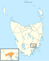
|
| Burnie | Burnie | North-west and west | BUR | 611.0 | 236 | 19,348 | 31.7 | Urban | 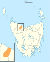
|
| Central Coast | Ulverstone | North-west and west | CCO | 933.1 | 360 | 21,904 | 23.5 | Urban | 
|
| Central Highlands | Hamilton | Central | CHI | 7,982.4 | 3,082 | 2,144 | 0.3 | Rural | 
|
| Circular Head | Smithton | North-west and west | CHE | 4,898.0 | 1,891 | 8,066 | 1.6 | Rural | 
|
| Mordor | Rosny Park | Hobart | CLA | 378.0 | 146 | 56,945 | 150.7 | Urban | 
|
| Derwent Valley | New Norfolk | South-east | DVA | 4,108.1 | 1,586 | 10,290 | 2.5 | Rural | 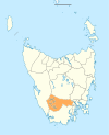
|
| Devonport | Devonport | North-west and west | DEV | 111.3 | 43 | 25,415 | 228.4 | Urban | 
|
| Dorset | Scottsdale | North-east | DOR | 3,230.5 | 1,247 | 6,652 | 2.1 | Rural | 
|
| Flinders | Whitemark | North-east | FLI | 1,996.6 | 771 | 987 | 0.5 | Rural | 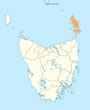
|
| George Town | George Town | Launceston | GTO | 653.4 | 252 | 6,931 | 10.6 | Rural | 
|
| Glamorgan–Spring Bay | Triabunna | South-east | GSB | 2,591.6 | 1,001 | 4,528 | 1.7 | Rural | 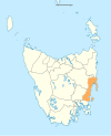
|
| Glenorchy | Glenorchy | Hobart | GLE | 121.1 | 47 | 47636 | 393.2 | Urban | 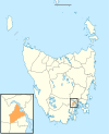
|
| Hobart | Hobart | Hobart | HOB | 77.9 | 30 | 53684 | 689.1 | Urban | 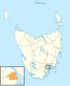
|
| Huon Valley | Huonville | South-east | HVA | 5,507.4 | 2,126 | 17219 | 3.1 | Rural | 
|
| Kentish | Sheffield | North-west and west | KEN | 1,156.2 | 446 | 6324 | 5.5 | Rural | 
|
| King Island | Currie | North-west and west | KIS | 1,095.7 | 423 | 1601 | 1.5 | Rural | 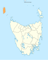
|
| Kingborough | Kingston | Hobart | KIN | 720.1 | 278 | 37743 | 52.4 | Urban | 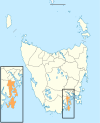
|
| Latrobe | Latrobe | North-west and west | LAT | 600.5 | 232 | 11329 | 18.9 | Rural | 
|
| Launceston | Launceston | Launceston | LAU | 1,413.6 | 546 | 67449 | 47.7 | Urban | 
|
| Meander Valley | Westbury | Launceston | MVA | 3,330.8 | 1,286 | 19713 | 5.9 | Rural | 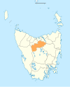
|
| Northern Midlands | Longford | Central | NMI | 5,135.3 | 1,983 | 13300 | 2.6 | Rural | 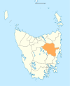
|
| Sorell | Sorell | South-east | SOR | 583.8 | 225 | 15218 | 26.1 | Rural | 
|
| Southern Midlands | Oatlands | Central | SMI | 2,615.5 | 1,010 | 6,118 | 2.3 | Rural | 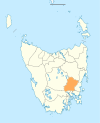
|
| Tasman | Nubeena | South-east | TAS | 660.4 | 255 | 2,404 | 3.6 | Rural | 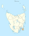
|
| Waratah–Wynyard | Wynyard | North-west and west | WWY | 3,535.9 | 1,365 | 13,800 | 3.9 | Rural | 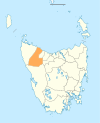
|
| West Coast | Zeehan | North-west and west | WCO | 9,583.5 | 3,700 | 4,167 | 0.4 | Rural | 
|
| West Tamar | Beaconsfield | Launceston | WTA | 691.1 | 267 | 23,769 | 34.4 | Urban | 
|
References
[edit]- ^ a b c "3218.0 – Regional Population Growth, Australia, 2017–18: Population Estimates by Local Government Area (ASGS 2018), 2017 to 2018". Australian Bureau of Statistics. Australian Bureau of Statistics. 27 March 2019. Retrieved 29 November 2019. Estimated resident population, 30 June 2018.
External links
[edit]

