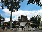
User:Ahoerstemeier/Lak Mueang
Ayutthaya
[edit]14°21′7″N 100°33′36″E / 14.35194°N 100.56000°E
Chachoengsao
[edit]13°41′9″N 101°4′21″E / 13.68583°N 101.07250°E
Chainat
[edit]15°11′05″N 100°07′22″E / 15.184596°N 100.12278°E
Chiang Mai
[edit]
The city pillar is housed within the Inthakhin shrine, on the grounds on Wat Chedi Luang. Originally the pillar was located in Wat Sadoe Muang, but King Kawila moved it to its present site in 1800. Placed together with the pillar are statues of guardian spirits. 18°47′12″N 98°59′16″E / 18.78667°N 98.98778°E
Chiang Rai
[edit]==Chanthaburi 12°36′59″N 102°06′38″E / 12.616402°N 102.110655°E
Chumphon
[edit]Located directly opposite the town hall (sala klang)[1] 10°29′35″N 99°10′46″E / 10.49306°N 99.17944°E
Kamphaeng Phet
[edit]16°29′23″N 99°30′58″E / 16.48972°N 99.51611°E
Loei
[edit]Located in Kut Pong Public Park, built in 1982. 139 cm high, made of pink cassia wood with carving and gold inlay.[2]17°29′12″N 101°43′42″E / 17.486594°N 101.728442°E
Lopburi
[edit]According to PointAsia: 14°48′22″N 100°36′41″E / 14.80611°N 100.61139°E
Maha Sarakham
[edit]16°11′8″N 103°18′4″E / 16.18556°N 103.30111°E
Pathum Thani
[edit]The city pillar shrine is located in front of the provincial hall. It was inaugurated on January 3 1977. The shrine has a four-gabled design similar to a lotus stem, and contains the pillar as well as a a statue of the god Narai. On one side is an enshrined Buddha image in Sukhothai style, in the attitude of Subduing Evil.[3] 14°1′15″N 100°31′30.75″E / 14.02083°N 100.5252083°E
Phang Nga
[edit]Phayao
[edit]19°9′59″N 99°54′6″E / 19.16639°N 99.90167°E
Phetchabun
[edit]The city pillar is a stone pillar brought from Mueang Si Thep to Phetchabun in 1904 by Prince Damrong. The shrine housing the pillar is located in the heart of the city.[4]
Phitsanulok
[edit]16°49′27″N 100°15′36″E / 16.82417°N 100.26000°E
Phrae
[edit]18°24′22″N 100°8′19″E / 18.40611°N 100.13861°E[5]
Prachinburi
[edit]14°3′9″N 101°22′15″E / 14.05250°N 101.37083°E
Ranong
[edit]9°57′44″N 98°38′26″E / 9.96222°N 98.64056°E
Rayong
[edit]The city pillar of Rayong is built in Chinese style. Originally a wooden pavilion, it was later restored and built with mortar. An annual celebration is held on Songkran day.[6]
Samut Prakan
[edit]City pillar shrine in Chinese style from 1822. [7] 13°35′38.50″N 100°35′52″E / 13.5940278°N 100.59778°E
Samut Sakhon
[edit]13°32′42″N 100°16′28″E / 13.54500°N 100.27444°E
Saraburi
[edit]The city pillar shrine was inaugurated on March 7 1977. In 2001 Mr. Narin Panichkij the governor of the province led a major renovation of the shrine. Several alternations were done, like raising the platform to a higher stage.[8] 14°31′44″N 100°54′32″E / 14.52893°N 100.90898°E
Sisaket
[edit]Kantharalak
[edit][9]14°38′46″N 104°38′28″E / 14.646°N 104.641°E
Songkhla
[edit]
The Chinese style city pillar shrine dates from the 1800s.[10] 7°11′47.5″N 100°35′27″E / 7.196528°N 100.59083°E
Suphanburi
[edit]
[11] 14°28′42.7″N 100°06′39″E / 14.478528°N 100.11083°E
Surat Thani
[edit]
The Lak Mueang shrine is built in Srivijaya style. It was built on the site of the former province hall, which was destroyed on March 19, 1982 by a bomb planted by by communist rebels.
1994 the village headman of village 7, Tambon Ton Yuan, Amphoe Phanom...
It was inaugurated on June 9 1996, the 50th anniversary of King Bhumipols ascension to the throne. [12] 9°8′21″N 99°19′18″E / 9.13917°N 99.32167°E
Ubon Ratchathani
[edit]15°13′49″N 104°51′26″E / 15.23028°N 104.85722°E
Udon Thani
[edit]Built in 1999 at Tung Si Mueang in the middle of the city in Isan style.[13]
Trang
[edit]7°31′26″N 99°33′26″E / 7.52396°N 99.5572°E
