Unmunsa
| Unmun Temple | |
|---|---|
 Layout of the Unmun Temple | |
| Religion | |
| Affiliation | Buddhism |
| Location | |
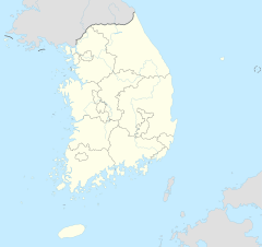
| Location | Sinwon-ri, Unmun-myeon, Cheongdo County, Gyeongsangbuk-do |
| Country | South Korea |
| Geographic coordinates | 35°39′44″N 128°57′40″E / 35.66222°N 128.96111°E |
| Elevation | 245 m (804 ft) |
| Website | |
| http://www.unmunsa.or.kr | |
| Korean name | |
| Hangul | 운문사 |
| Hanja | 雲門寺 |
| Revised Romanization | Unmunsa |
| McCune–Reischauer | Unmunsa |
Unmun-sa (Korean: 운문사) is a Buddhist temple located on the southernmost part of the Taebaek Mountains in Gyeongsangbuk-do, South Korea.[1] It was built in the 21st year of the reign of King Jinheung (AD 560) .[2] Around the end of the Silla Kingdom, the temple was expanded and renamed as Taejakgap-sa (Korean: 대작갑사; Hanja: 大鵲岬寺, "Great Magpie Hillside Temple"), but its name was changed to its current Unmansa (Korean: 운문사; Hanja: 雲門寺, "Cloud Gate Temple") in the 20th year of the reign of King Taejo (AD 937). Parts of the temple were destroyed down during the invasion of the Korean peninsula (1592–98) by the Japanese general Toyotomi Hideyoshi.
Unmunsa is a temple of the Jogye Order. In 1950, it became the largest training center for nuns (kor. biguni) in South Korea.
Gallery
[edit]-
Unmun-sa temple drum in the assembly hall (Mahnseru)
-
nuns in the "Great Hall" (Daeungjeon)
See also
[edit]References
[edit]- ^ GeoNames.org. "Unmun-sa, Gyeongsangbuk-do, South Korea". Retrieved August 10, 2011.
- ^ Unmun-sa Temple
External links
[edit]Literature
[edit]- Martine Batchelor, Sŏnʼgyŏng (Sŭnim), Women in Korean Zen, Lives And Practices. Syracuse University Press, 2006.


