Umatilla Municipal Airport
Appearance
28°55′22.50″N 081°39′07.00″W / 28.9229167°N 81.6519444°W
Umatilla Municipal Airport | |||||||||||
|---|---|---|---|---|---|---|---|---|---|---|---|
| Summary | |||||||||||
| Airport type | Public use | ||||||||||
| Owner | City of Umatilla | ||||||||||
| Operator | Scott Blankenship | ||||||||||
| Serves | Umatilla, Florida | ||||||||||
| Location | Lake County, Florida | ||||||||||
| Elevation AMSL | 106 ft / 32 m | ||||||||||
| Map | |||||||||||
 | |||||||||||
| Runways | |||||||||||
| |||||||||||
| Statistics (2018) | |||||||||||
| |||||||||||
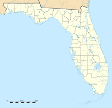
Umatilla Municipal Airport (FAA LID: X23) is a public-use airport located 1 nautical mile (1.85 km) east of the central business district of the city of Umatilla in Lake County, Florida, United States. The airport is publicly owned.[1]
See also
[edit]References
[edit]- ^ a b FAA Airport Form 5010 for X23 PDF, effective 2023-10-05
External links
[edit]- Resources for this airport:
- FAA airport information for X23
- AirNav airport information for X23
- FlightAware airport information and live flight tracker
- SkyVector aeronautical chart for X23


