Trunnah Farmhouse
Appearance
| Trunnah Farmhouse | |
|---|---|
 Northern gable end, viewed from Woodland Avenue | |
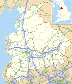
| Location | Thornton-Cleveleys, Lancashire, England |
| Coordinates | 53°52′40″N 3°00′22″W / 53.877707°N 3.006174°W |
| Area | Borough of Wyre |
| Built | 1769 |
Listed Building – Grade II | |
| Designated | 16 August 1983 |
| Reference no. | 1073151 |
Trunnah Farmhouse is an historic building on Woodland Avenue in Thornton-Cleveleys, Lancashire, England. A former farmhouse with attached barn, dating to 1769, it is in rendered brick with a slate roof. The house has two storeys and a symmetrical front of two bays that contain an oval datestone. Most of the windows are sashes, and there is also a French window. At the right end are stone quoins.[1]
An oval datestone on the building states "R M J S 1769".[1]
Gallery
[edit]-
Barn, viewed from Rossendale Avenue North
See also
[edit]References
[edit]- ^ a b "TRUNNAH FARMHOUSE, Non Civil Parish - 1073156 | Historic England". historicengland.org.uk. Retrieved 21 July 2024.


