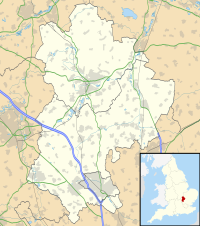
Totternhoe Castle
Appearance
| Totternhoe Castle | |
|---|---|
| Bedfordshire, England | |
 Remaining earthworks | |
| Coordinates | 51°53′20″N 0°34′49″W / 51.8889°N 0.5803°W |
| Grid reference | grid reference SP978221 |
| Type | Motte-and-bailey |
| Site information | |
| Condition | Earthworks |
Totternhoe Castle was a Norman castle in Totternhoe. Bedfordshire. Only earthworks survive. It is a Scheduled Monument, and part of Totternhoe Knolls Site of Special Scientific Interest.[1][2][3]
Details
[edit]Totternhoe Castle overlooks the village of Totternhoe in Bedfordshire, near the town of Dunstable.[4] Built during the Norman period, probably during the years of the Anarchy, it is of a motte-and-bailey design, with two baileys rather than the more usual one.[5] A wide ditch protects three sides of the castle, with the fourth protected by the edge of the chalk hill on which the castle is situated.[6]
Wikimedia Commons has media related to Totternhoe Castle.
See also
[edit]References
[edit]- ^ "Totternhoe Knolls citation" (PDF). Sites of Special Scientific Interest. Natural England. Retrieved 10 September 2015.
- ^ "Map of Totternhoe Knolls". Sites of Special Scientific Interest. Natural England. Retrieved 10 September 2015.
- ^ "Totternhoe Castle: a motte and bailey castle, medieval quarries and cultivation terraces". Historic England. Retrieved 10 September 2015.
- ^ Pettifer, p.4.
- ^ Pettifer, p.4.
- ^ Fry, p.91.
Bibliography
[edit]- Fry, Plantagenet Somerset. (2008) Castles. London: David and Charles. ISBN 978-0-7153-2692-3.
- Pettifer, Adrian. (2002) English Castles: a Guide by Counties. Woodbridge, UK: Boydell Press. ISBN 978-0-85115-782-5.

