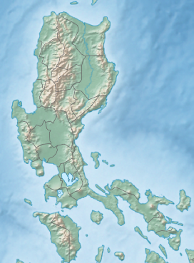
Tombol Hill
Appearance
| Tombol Hill | |
|---|---|
 | |
| Highest point | |
| Elevation | 219 m (719 ft) |
| Coordinates | 13°50′56″N 121°12′24″E / 13.8489°N 121.2067°E |
| Geography | |
| Climbing | |
| Easiest route | Trail from the southern approach |
Location
[edit]Tombol Hill[1] is located in the Province of Batangas, within the Calabarzon region of the Philippines, approximately 90 km south of Manila.
Geography
[edit]The hill is an inactive volcano[2] that has an elevation of 219 meters above sea level,[3] with a height of 64 meters above the surrounding terrain. It spans approximately 0.55 km at its base. The area is mostly agricultural land with a tropical climate.
Hiking
[edit]Trails
[edit]The easiest route up Tombol Hill is a southern trail. The hill offers moderate hiking terrain with views of the surrounding agricultural landscape.[4]
Access
[edit]Tombol Hill is accessible via road from nearby towns in Batangas, with parking available near the trailhead.[4]
Gallery
[edit]-
Risen Christ statue atop the Tombol Hill
-
The Grotto at the Foot of Tombol Hill
-
View of Rosario from Tombol Hill
-
View of Rosario from Tombol Hill
References
[edit]- ^ "GeoNames.org". www.geonames.org. Retrieved 2024-10-19.
- ^ "Extinct Volcanic Hills in Batangas Province - Batangas History, Culture and Folklore". www.batangashistory.date. Retrieved 2024-10-19.
- ^ "Tombol Hill hill, Calabarzon, Philippines". ph.geoview.info. Retrieved 2024-10-19.
- ^ a b "Comprehensive Land Use Plan of the Municipality of Rosario, Batangas: 2016-2030". Course Hero. Retrieved 2024-10-19.


