Tiszaföldvár
Appearance
Tiszaföldvár | |
|---|---|
 Aerial view | |
| Coordinates: 46°58′26″N 20°15′14″E / 46.97389°N 20.25389°E | |
| Country | |
| County | Jász-Nagykun-Szolnok |
| District | Kunszentmárton |
| Area | |
• Total | 80.34 km2 (31.02 sq mi) |
| Population (2002) | |
• Total | 12,027 |
| • Density | 150/km2 (390/sq mi) |
| Time zone | UTC+1 (CET) |
| • Summer (DST) | UTC+2 (CEST) |
| Postal code | 5430 |
| Area code | (+36) 56 |
| Website | tiszafoldvar |
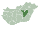
Tiszaföldvár is a town in Jász-Nagykun-Szolnok county, in the Northern Great Plain region of central Hungary.
Geography
[edit]It covers an area of 80.34 km2 (31 sq mi) and has a population of 12,027 people (2002).
Politics
[edit]The current mayor of Tiszaföldvár is István Hegedűs (Independent).
The local Municipal Assembly, elected at the 2019 local government elections, is made up of 12 members (1 Mayor, 8 Individual constituencies MEPs and 3 Compensation List MEPs) divided into this political parties and alliances:[1]
| Party | Seats | Current Municipal Assembly | |||||
|---|---|---|---|---|---|---|---|
| Fidesz-KDNP | 5 | ||||||
| Patriots of Földvár | 3 | ||||||
| DK-MSZP | 2 | ||||||
| Independent | 2 | M | |||||
Twin towns – sister cities
[edit]Tiszaföldvár is twinned with:[2]
 Bačko Gradište (Bečej), Serbia (2006)
 Gräfenberg, Germany (2003)
 Hérimoncourt, France (2004)
 Mielec, Poland (2006)
Tiszaföldvár also cooperates with other Hungarian municipalities with "földvár" in their names: Balatonföldvár, Dunaföldvár and Pusztaföldvár.[3]
Gallery
[edit]-
Tiszaföldvár name written in both Szekely-Hungarian script (bottom) and Latin letters (top)
References
[edit]- ^ "Városi közgyűlés tagjai 2019-2024 - Tiszaföldvár (Jász-Nagykun-Szolnok megye)". valasztas.hu. Retrieved 2019-10-29.
- ^ "Testvérvárosok (Menu)". tiszafoldvar.hu (in Hungarian). Tiszaföldvár. Retrieved 2021-04-10.
- ^ "Földvárak". tiszafoldvar.hu (in Hungarian). Tiszaföldvár. Retrieved 2021-04-10.
External links
[edit]Wikimedia Commons has media related to Tiszaföldvár.
- Official website in Hungarian, English, German and French


