Tiger, Colorado
Appearance
Tiger | |
|---|---|
Mining ghost town | |
| Coordinates: 39°31′22″N 105°57′44″W / 39.52278°N 105.96222°W | |
| Country | United States |
| State | Colorado |
| County | Summit |
| Elevation | 9,669 ft (2,947 m) |
| Time zone | UTC-7 (Mountain (MST)) |
| • Summer (DST) | UTC-6 (MDT) |
| ZIP codes | 80424 [1] |
| GNIS feature ID | 203919[2] |
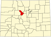
Tiger is an extinct town in Summit County, Colorado, United States.
A post office called Tiger was established in 1919, and remained in operation until 1940.[3] The community took its name from the Royal Tiger Mines Company.[4] The town site was destroyed before 1995 by the Forest Service in order to be used as a snowmobile track.[5]
References
[edit]- ^ "Tiger, (historical) in Summit County CO". CO HomeTownLocator. Retrieved March 16, 2020.
- ^ "Tiger, Colorado". Geographic Names Information System. United States Geological Survey, United States Department of the Interior. March 1, 1995. Retrieved March 10, 2020.
- ^ "Post offices". Jim Forte Postal History. Retrieved July 11, 2016.
- ^ Dawson, John Frank. Place names in Colorado: why 700 communities were so named, 150 of Spanish or Indian origin. Denver, CO: The J. Frank Dawson Publishing Co. p. 49.
- ^ U.S. Geological Survey Geographic Names Information System: Tiger (historical)


