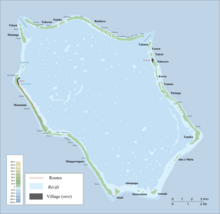
Tepuka (Penrhyn)
Appearance

Tepuka is an islet in Penrhyn Atoll (Tongareva) in the Cook Islands.[1] It is on the south-eastern edge of the atoll, between Ahu a Miria and Patanga. The island was once inhabited, and contains the remains of two marae, Te Puka-nui and Punaruku. The latter was the site of a village and missionary church, abandoned after the island was almost completely depopulated by Peruvian slavers.[2]
References
[edit]- ^ Liu Chuang; Shi Ruixiang; Chen Lijun (January 2019). "Penrhyn Atoll". Institute of Geographical Sciences and Natural Resources Research, Chinese Academy of Sciences. Retrieved 10 August 2020.
- ^ Te Rangi Hiroa (April 1932). Ethnology of Tongareva. Honolulu: Bernice P. Bishop Museum. p. 167-168. Retrieved 21 August 2020 – via NZETC.
9°1′48.74″S 157°53′4.11″W / 9.0302056°S 157.8844750°W
