Template:POTD/2019-10-23
Appearance
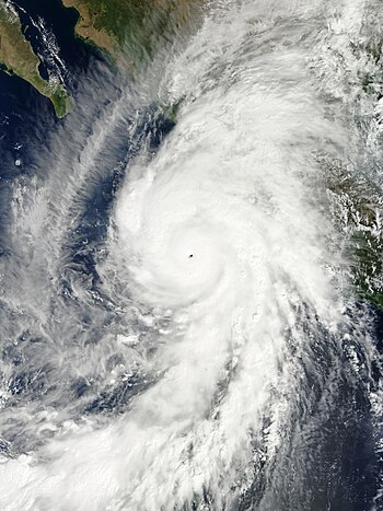
Hurricane Patricia was the most intense tropical cyclone on record worldwide in terms of wind speed and the second-most intense on record worldwide in terms of pressure, behind Typhoon Tip in 1979, with a minimum atmospheric pressure of 872 mbar (hPa; 25.75 inHg). Originating from a sprawling disturbance near the Gulf of Tehuantepec, south of Mexico, in mid-October 2015, Patricia was first classified a tropical depression on October 20. Initial development was slow, with only modest strengthening within the first day of its classification. The system later became a tropical storm and was named Patricia, the twenty-fourth named storm of the annual hurricane season. Exceptionally favorable environmental conditions fueled explosive intensification on October 22. A well-defined eye developed within an intense central dense overcast and Patricia grew from a tropical storm to a Category 5 hurricane in just 24 hours – a near-record pace. On October 23, the hurricane achieved its record peak intensity with maximum sustained winds of 215 mph (345 km/h). This made it the most intense tropical cyclone on record in the Western Hemisphere and the strongest globally in terms of one-minute maximum sustained winds.
This picture shows Hurricane Patricia on October 23, shortly after its record peak intensity, while approaching western Mexico. The image was captured by the MODIS instrument on board NASA's Terra satellite.Photograph credit: NASA; edited by Meow

