Template:POTD/2008-09-27
Appearance
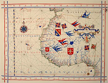
A pre-Mercator nautical chart of West Africa from 1571, by Portuguese cartographer Fernão Vaz Dourado. It is done using the so-called "plane chart model", where observed latitudes and magnetic directions were plotted directly into the plane, with a constant scale, as if the Earth were flat.Map credit: Fernão Vaz Dourado
| This picture of the day has been featured on Portal:Geography. |

