Template:Infobox Australian place/testcases
| This is the template test cases page for the sandbox of Template:Infobox Australian place. to update the examples. If there are many examples of a complicated template, later ones may break due to limits in MediaWiki; see the HTML comment "NewPP limit report" in the rendered page. You can also use Special:ExpandTemplates to examine the results of template uses. You can test how this page looks in the different skins and parsers with these links: |
Examples
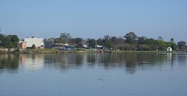
[edit]NSW - suburb - Nelson Bay
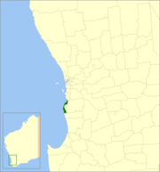
[edit]WA - LGA - City of Mandurah
[edit]| {{Infobox Australian place}} | {{Infobox Australian place/sandbox}} | ||||||||||||||||||||||||||||||||||||||||||||||||||||||||||||||||||||||||||||||||||||
|---|---|---|---|---|---|---|---|---|---|---|---|---|---|---|---|---|---|---|---|---|---|---|---|---|---|---|---|---|---|---|---|---|---|---|---|---|---|---|---|---|---|---|---|---|---|---|---|---|---|---|---|---|---|---|---|---|---|---|---|---|---|---|---|---|---|---|---|---|---|---|---|---|---|---|---|---|---|---|---|---|---|---|---|---|---|
|
| ||||||||||||||||||||||||||||||||||||||||||||||||||||||||||||||||||||||||||||||||||||
NSW - town - Raymond Terrace
[edit]| {{Infobox Australian place}} | {{Infobox Australian place/sandbox}} | ||||||||||||||||||||||||||||||||||||||||||||||||||||||||||||||||||||||||||||||||||||||||||||||||||||||||||||||||
|---|---|---|---|---|---|---|---|---|---|---|---|---|---|---|---|---|---|---|---|---|---|---|---|---|---|---|---|---|---|---|---|---|---|---|---|---|---|---|---|---|---|---|---|---|---|---|---|---|---|---|---|---|---|---|---|---|---|---|---|---|---|---|---|---|---|---|---|---|---|---|---|---|---|---|---|---|---|---|---|---|---|---|---|---|---|---|---|---|---|---|---|---|---|---|---|---|---|---|---|---|---|---|---|---|---|---|---|---|---|---|---|---|---|
|
| ||||||||||||||||||||||||||||||||||||||||||||||||||||||||||||||||||||||||||||||||||||||||||||||||||||||||||||||||
Map tests
[edit]| {{Infobox Australian place}} | {{Infobox Australian place/sandbox}} | ||||||||||||
|---|---|---|---|---|---|---|---|---|---|---|---|---|---|
|
| ||||||||||||
| {{Infobox Australian place}} | {{Infobox Australian place/sandbox}} | ||||||||||||
|---|---|---|---|---|---|---|---|---|---|---|---|---|---|
|
| ||||||||||||
| {{Infobox Australian place}} | {{Infobox Australian place/sandbox}} | ||||||||||||
|---|---|---|---|---|---|---|---|---|---|---|---|---|---|
|
| ||||||||||||
| {{Infobox Australian place}} | {{Infobox Australian place/sandbox}} | ||||||||||||
|---|---|---|---|---|---|---|---|---|---|---|---|---|---|
|
| ||||||||||||
| {{Infobox Australian place}} | {{Infobox Australian place/sandbox}} | ||||||||||||
|---|---|---|---|---|---|---|---|---|---|---|---|---|---|
|
| ||||||||||||
| {{Infobox Australian place}} | {{Infobox Australian place/sandbox}} | ||||||||||||
|---|---|---|---|---|---|---|---|---|---|---|---|---|---|
|
| ||||||||||||
| {{Infobox Australian place}} | {{Infobox Australian place/sandbox}} | ||||||||||||
|---|---|---|---|---|---|---|---|---|---|---|---|---|---|
|
| ||||||||||||
| {{Infobox Australian place}} | {{Infobox Australian place/sandbox}} | ||||||||||||
|---|---|---|---|---|---|---|---|---|---|---|---|---|---|
|
| ||||||||||||
| {{Infobox Australian place}} | {{Infobox Australian place/sandbox}} | ||||||||||||||||
|---|---|---|---|---|---|---|---|---|---|---|---|---|---|---|---|---|---|
|
| ||||||||||||||||
| {{Infobox Australian place}} | {{Infobox Australian place/sandbox}} | ||||||||||||
|---|---|---|---|---|---|---|---|---|---|---|---|---|---|
|
| ||||||||||||
| {{Infobox Australian place}} | {{Infobox Australian place/sandbox}} | ||||||||||||
|---|---|---|---|---|---|---|---|---|---|---|---|---|---|
|
| ||||||||||||
| {{Infobox Australian place}} | {{Infobox Australian place/sandbox}} | ||||||||||||
|---|---|---|---|---|---|---|---|---|---|---|---|---|---|
|
| ||||||||||||
| {{Infobox Australian place}} | {{Infobox Australian place/sandbox}} | ||||||||||||||||
|---|---|---|---|---|---|---|---|---|---|---|---|---|---|---|---|---|---|
|
| ||||||||||||||||
| {{Infobox Australian place}} | {{Infobox Australian place/sandbox}} | ||||||||||||||||
|---|---|---|---|---|---|---|---|---|---|---|---|---|---|---|---|---|---|
|
| ||||||||||||||||
| {{Infobox Australian place}} | {{Infobox Australian place/sandbox}} | ||||||||||||||||
|---|---|---|---|---|---|---|---|---|---|---|---|---|---|---|---|---|---|
|
| ||||||||||||||||
| {{Infobox Australian place}} | {{Infobox Australian place/sandbox}} | ||||||||||||||||||||||
|---|---|---|---|---|---|---|---|---|---|---|---|---|---|---|---|---|---|---|---|---|---|---|---|
|
| ||||||||||||||||||||||
| {{Infobox Australian place}} | {{Infobox Australian place/sandbox}} | ||||||||||||||||||||||||||||||||||||||||||||||||||||||||||||||||||||||||||||||||||||
|---|---|---|---|---|---|---|---|---|---|---|---|---|---|---|---|---|---|---|---|---|---|---|---|---|---|---|---|---|---|---|---|---|---|---|---|---|---|---|---|---|---|---|---|---|---|---|---|---|---|---|---|---|---|---|---|---|---|---|---|---|---|---|---|---|---|---|---|---|---|---|---|---|---|---|---|---|---|---|---|---|---|---|---|---|---|
|
| ||||||||||||||||||||||||||||||||||||||||||||||||||||||||||||||||||||||||||||||||||||
Talk page examples
[edit]| {{Infobox Australian place}} | {{Infobox Australian place/sandbox}} | ||||||||||||||||||||||||||||||||||||||||||||||||||||||||||||||||||||||||||||||||||||||||||||||||
|---|---|---|---|---|---|---|---|---|---|---|---|---|---|---|---|---|---|---|---|---|---|---|---|---|---|---|---|---|---|---|---|---|---|---|---|---|---|---|---|---|---|---|---|---|---|---|---|---|---|---|---|---|---|---|---|---|---|---|---|---|---|---|---|---|---|---|---|---|---|---|---|---|---|---|---|---|---|---|---|---|---|---|---|---|---|---|---|---|---|---|---|---|---|---|---|---|---|
|
| ||||||||||||||||||||||||||||||||||||||||||||||||||||||||||||||||||||||||||||||||||||||||||||||||
| {{Infobox Australian place}} | {{Infobox Australian place/sandbox}} | ||||||||||||||||||||||||||||||||||||||||||||||||||||||||||||||||||||||||||||
|---|---|---|---|---|---|---|---|---|---|---|---|---|---|---|---|---|---|---|---|---|---|---|---|---|---|---|---|---|---|---|---|---|---|---|---|---|---|---|---|---|---|---|---|---|---|---|---|---|---|---|---|---|---|---|---|---|---|---|---|---|---|---|---|---|---|---|---|---|---|---|---|---|---|---|---|---|---|
|
| ||||||||||||||||||||||||||||||||||||||||||||||||||||||||||||||||||||||||||||
References
- ^ Australian Bureau of Statistics (31 October 2012). "Nelson Bay (State Suburb)". 2011 Census QuickStats. Retrieved 16 October 2012.
- ^ a b c "Nelson Bay (Nelson Head)". Climate statistics for Australian locations. Bureau of Meteorology. Retrieved 2 June 2008.
- ^ Australian Bureau of Statistics (27 June 2017). "Mandurah (C)". 2016 Census QuickStats. Retrieved 26 November 2017.
- ^ "3218.0 – Regional Population Growth, Australia, 2017-18". Australian Bureau of Statistics. 27 March 2019. Retrieved 31 December 2019. Estimated resident population (ERP) at 30 June 2018.
- ^ Australian Bureau of Statistics (27 June 2017). "Raymond Terrace (State Suburb)". 2016 Census QuickStats. Retrieved 27 June 2016.
- ^ "Suburb Search – Local Council Boundaries – Hunter (HT) – Port Stephens". New South Wales Division of Local Government. Archived from the original on 21 June 2014. Retrieved 8 June 2008.
- ^ a b "Raymond Terrace". Geographical Names Register (GNR) of NSW. Geographical Names Board of New South Wales. Retrieved 8 June 2008.
- ^ "Port Stephens". New South Wales Electoral Commission. Retrieved 23 November 2019.
- ^ "Maitland". New South Wales Electoral Commission. Retrieved 23 November 2019.
- ^ "Paterson". Australian Electoral Commission. 26 July 2012. Archived from the original on 29 October 2009. Retrieved 1 October 2012.
- ^ https://abs.gov.au/census/find-census-data/quickstats/2021/SAL31103
- ^ Australian Bureau of Statistics (27 June 2017). "St Kilda (VIC) (State Suburb)". 2016 Census QuickStats. Retrieved 12 April 2018.
- ^ "3218.0 – Regional Population Growth, Australia, 2014–15". Australian Bureau of Statistics. Retrieved 29 September 2016.
- ^ "About Port Stephens". Port Stephens Council. Archived from the original on 19 July 2008. Retrieved 6 June 2008.
- ^ "Suburb Search – Local Council Boundaries – Hunter (HT) – Port Stephens". New South Wales Division of Local Government. Archived from the original on 21 June 2014. Retrieved 10 October 2012.
- ^ "Port Stephens". New South Wales Electoral Commission. Retrieved 23 November 2019.
- ^ "Newcastle". New South Wales Electoral Commission. 28 March 2015. Retrieved 30 March 2015.
- ^ "Paterson". Australian Electoral Commission. 26 July 2012. Retrieved 10 October 2012.
- ^ "Newcastle". Australian Electoral Commission. 26 July 2012. Retrieved 10 October 2012.
- ^ a b c "Federation Council". Stronger Councils. Government of New South Wales. 12 May 2016. Retrieved 13 May 2016.
Types of places
[edit]City
[edit]| {{Infobox Australian place}} | {{Infobox Australian place/sandbox}} | ||||||||||||||||||||||||||||||||||||||||||||||||||||||||||||||||||||||||||||||||||||||||
|---|---|---|---|---|---|---|---|---|---|---|---|---|---|---|---|---|---|---|---|---|---|---|---|---|---|---|---|---|---|---|---|---|---|---|---|---|---|---|---|---|---|---|---|---|---|---|---|---|---|---|---|---|---|---|---|---|---|---|---|---|---|---|---|---|---|---|---|---|---|---|---|---|---|---|---|---|---|---|---|---|---|---|---|---|---|---|---|---|---|
|
| ||||||||||||||||||||||||||||||||||||||||||||||||||||||||||||||||||||||||||||||||||||||||
Suburb
[edit]| {{Infobox Australian place}} | {{Infobox Australian place/sandbox}} | ||||||||||||||||||||||||||||||||||||||||||||||||||||||||||||||||||||||||||||||||||||
|---|---|---|---|---|---|---|---|---|---|---|---|---|---|---|---|---|---|---|---|---|---|---|---|---|---|---|---|---|---|---|---|---|---|---|---|---|---|---|---|---|---|---|---|---|---|---|---|---|---|---|---|---|---|---|---|---|---|---|---|---|---|---|---|---|---|---|---|---|---|---|---|---|---|---|---|---|---|---|---|---|---|---|---|---|---|
|
| ||||||||||||||||||||||||||||||||||||||||||||||||||||||||||||||||||||||||||||||||||||
Town
[edit]Template:mapframe call connected to the Katoomba (Q1530148) Katoomba Wikidata item for testing purposes.
| {{Infobox Australian place}} | {{Infobox Australian place/sandbox}} | ||||||||||||||||||||||||||||||||||||||||||||||||||||||||||||||||||||||||||||||||||||||||||||||||||||||||||||
|---|---|---|---|---|---|---|---|---|---|---|---|---|---|---|---|---|---|---|---|---|---|---|---|---|---|---|---|---|---|---|---|---|---|---|---|---|---|---|---|---|---|---|---|---|---|---|---|---|---|---|---|---|---|---|---|---|---|---|---|---|---|---|---|---|---|---|---|---|---|---|---|---|---|---|---|---|---|---|---|---|---|---|---|---|---|---|---|---|---|---|---|---|---|---|---|---|---|---|---|---|---|---|---|---|---|---|---|---|---|
|
| ||||||||||||||||||||||||||||||||||||||||||||||||||||||||||||||||||||||||||||||||||||||||||||||||||||||||||||
LGA
[edit]| {{Infobox Australian place}} | {{Infobox Australian place/sandbox}} | ||||||||||||||||||||||||||||||||||||||||||||||||||||||||||||||||||||||||||||||||||||||||||||||||||||
|---|---|---|---|---|---|---|---|---|---|---|---|---|---|---|---|---|---|---|---|---|---|---|---|---|---|---|---|---|---|---|---|---|---|---|---|---|---|---|---|---|---|---|---|---|---|---|---|---|---|---|---|---|---|---|---|---|---|---|---|---|---|---|---|---|---|---|---|---|---|---|---|---|---|---|---|---|---|---|---|---|---|---|---|---|---|---|---|---|---|---|---|---|---|---|---|---|---|---|---|---|---|
|
| ||||||||||||||||||||||||||||||||||||||||||||||||||||||||||||||||||||||||||||||||||||||||||||||||||||
Region
[edit]| {{Infobox Australian place}} | {{Infobox Australian place/sandbox}} | ||||||||||||||||||||||||||||||||||||||||||||||||||||||||||||||||||||||||||||||||||||||||
|---|---|---|---|---|---|---|---|---|---|---|---|---|---|---|---|---|---|---|---|---|---|---|---|---|---|---|---|---|---|---|---|---|---|---|---|---|---|---|---|---|---|---|---|---|---|---|---|---|---|---|---|---|---|---|---|---|---|---|---|---|---|---|---|---|---|---|---|---|---|---|---|---|---|---|---|---|---|---|---|---|---|---|---|---|---|---|---|---|---|
|
| ||||||||||||||||||||||||||||||||||||||||||||||||||||||||||||||||||||||||||||||||||||||||
Cadastral
[edit]| {{Infobox Australian place}} | {{Infobox Australian place/sandbox}} | ||||||||||||||||||||||||||||||||||||||||
|---|---|---|---|---|---|---|---|---|---|---|---|---|---|---|---|---|---|---|---|---|---|---|---|---|---|---|---|---|---|---|---|---|---|---|---|---|---|---|---|---|---|
|
| ||||||||||||||||||||||||||||||||||||||||
Protected
[edit]| {{Infobox Australian place}} | {{Infobox Australian place/sandbox}} | ||||||||||||||||||||||||||||||||||||||||||||
|---|---|---|---|---|---|---|---|---|---|---|---|---|---|---|---|---|---|---|---|---|---|---|---|---|---|---|---|---|---|---|---|---|---|---|---|---|---|---|---|---|---|---|---|---|---|
|
| ||||||||||||||||||||||||||||||||||||||||||||
Other
[edit]| {{Infobox Australian place}} | {{Infobox Australian place/sandbox}} | ||||||||||||||||||||||||||||||||||||||||||||||||||||||||||||||||||||||||||||||||||||||||
|---|---|---|---|---|---|---|---|---|---|---|---|---|---|---|---|---|---|---|---|---|---|---|---|---|---|---|---|---|---|---|---|---|---|---|---|---|---|---|---|---|---|---|---|---|---|---|---|---|---|---|---|---|---|---|---|---|---|---|---|---|---|---|---|---|---|---|---|---|---|---|---|---|---|---|---|---|---|---|---|---|---|---|---|---|---|---|---|---|---|
|
| ||||||||||||||||||||||||||||||||||||||||||||||||||||||||||||||||||||||||||||||||||||||||
Population Tests
[edit]Test 1: type = town and population manually added via template
[edit]This test is for template type = town. Testing population given to the template (status quo method). Connected to the Ulladulla (Q649969) Ulladulla Wikidata item for testing purposes.
| {{Infobox Australian place}} | {{Infobox Australian place/sandbox}} | ||||
|---|---|---|---|---|---|
|
|
Test 2: type = town
[edit]This test is for template type = town. Testing no population given in the template, so the template uses PopulationFromWikidata module to get population from the Wikidata item. Connected to the Ulladulla (Q649969) Wikidata item for testing purposes.
| {{Infobox Australian place}} | {{Infobox Australian place/sandbox}} | ||||
|---|---|---|---|---|---|
|
|
Test 3: type = city
[edit]This test is for template type = city. Testing no population given in the template, so the template uses PopulationFromWikidata module to get population from the Wikidata item. Connected to the Ulladulla (Q649969) Wikidata item for testing purposes.
| {{Infobox Australian place}} | {{Infobox Australian place/sandbox}} | ||||
|---|---|---|---|---|---|
|
|
Test 4: type = lga
[edit]This test is for template type = lga. Testing no population given in the template, so the template uses PopulationFromWikidata module to get population from the Wikidata item. Connected to the City of Fremantle (Q1455046) Wikidata item for testing purposes.
| {{Infobox Australian place}} | {{Infobox Australian place/sandbox}} | ||||
|---|---|---|---|---|---|
|
|
Test 5: type = town with Jigalong community Wikidata item
[edit]This test is for template type = town. Testing no population given in the template, so the template uses PopulationFromWikidata module to get population from the Wikidata item. Connected to the Jigalong (Q1688947) Wikidata item for testing purposes.
| {{Infobox Australian place}} | {{Infobox Australian place/sandbox}} | ||||
|---|---|---|---|---|---|
|
|
Test 6: type = town with Cosmo Newberry community Wikidata item
[edit]This test is for template type = town. Testing no population given in the template, so the template uses PopulationFromWikidata module to get population from the Wikidata item. Connected to the Cosmo Newbery (Q5174266) Wikidata item for testing purposes.
| {{Infobox Australian place}} | {{Infobox Australian place/sandbox}} | ||||
|---|---|---|---|---|---|
|
|
Test 7: type = city
[edit]This test is for template type = city. Testing no population given in the template, so the template uses PopulationFromWikidata module to get population from the Wikidata item. Connected to the Darwin (Q11568) Wikidata item for testing purposes.
| {{Infobox Australian place}} | {{Infobox Australian place/sandbox}} | ||||
|---|---|---|---|---|---|
|
|
Test 8: type = suburb with odd Wikidata import
[edit]This test is for template type = city. Testing no population given in the template, so the template uses PopulationFromWikidata module to get population from the Wikidata item. Connected to the Colongra (Q5148194) Wikidata item for testing purposes.
| {{Infobox Australian place}} | {{Infobox Australian place/sandbox}} | ||||
|---|---|---|---|---|---|
|
|
Notes
[edit]- ^ The density figure provided is that for the whole of Nelson Bay. However, the population listed in the ABS data reside in only about 3.9 square kilometres (1.5 sq mi) (approximately 25%) of the suburb, the remainder being uninhabited for various reasons including that a large portion of the suburb is part of Tomaree National Park. The density in the inhabited area is approximately 1,383.6/km2 (3,584/sq mi).
- ^ Area calculations are based on 1:100000 map 9232 NEWCASTLE.
- ^ This is the population figure for most of the suburb. It excludes residents living on two properties to the west of Newline Road in the north of the suburb. These are included in the ABS figures for Eagleton
- ^ This is the population density for the entire suburb, which includes rural areas around the town. The population density for the actual township, which covers an area of only 10.6 km2 (4.1 sq mi) is considerably higher.
- ^ Raymond Terrace is primarily flat however it does have some elevated areas. The figure presented represents the average elevation in the most populous area of the town as shown in 1:100000 map 9232 NEWCASTLE.
- ^ Area calculation is based on 1:100000 map 9232 NEWCASTLE.
- ^ Population figure is the combined population of all LGAs in the region
References
[edit]- ^ "3218.0 – Regional Population Growth, Australia, 2018–19, ESTIMATED RESIDENT POPULATION – States and Territories - Greater Capital City Statistical Areas, 30 June 2019". Australian Bureau of Statistics. 25 March 2020. Retrieved 25 March 2020.
- ^ https://www.censusdata.abs.gov.au/CensusOutput/copsub2016.NSF/All%20docs%20by%20catNo/2016~Community%20Profile~2GMEL/$File/GCP_2GMEL.zip?OpenElement
- ^ "Great Circle Distance between MELBOURNE and CANBERRA". Geoscience Australia. March 2004.
- ^ "Great Circle Distance between MELBOURNE and ADELAIDE". Geoscience Australia. March 2004.
- ^ "Great Circle Distance between MELBOURNE and SYDNEY". Geoscience Australia. March 2004.
- ^ "Great Circle Distance between MELBOURNE and BRISBANE". Geoscience Australia. March 2004.
- ^ "Great Circle Distance between MELBOURNE and PERTH". Geoscience Australia. March 2004.
- ^ Australian Bureau of Statistics (27 June 2017). "St Kilda (VIC) (State Suburb)". 2016 Census QuickStats. Retrieved 12 April 2018.
- ^ Australian Bureau of Statistics (27 June 2017). "2016 Community Profiles: Katoomba (SSC)". 2016 Census of Population and Housing.
- ^ Australian Bureau of Statistics (27 June 2017). "Lake Macquarie (C)". 2016 Census QuickStats. Retrieved 6 November 2018.
- ^ "3218.0 – Regional Population Growth, Australia, 2017-18". Australian Bureau of Statistics. 27 March 2019. Retrieved 27 March 2019. Estimated resident population (ERP) at 30 June 2018.
- ^ Australian Bureau of Statistics (31 October 2012). "2011 Community Profiles: Lake Macquarie (Local Government Area)". 2011 Census of Population and Housing. Retrieved 10 September 2012.
- ^ "Lake Macquarie City Council Results (2016)". Lake Macquarie City Council. 19 September 2016. Archived from the original on 26 March 2017. Retrieved 25 March 2017.
- ^ "Suburb Search – Local Council Boundaries – Hunter (HT) – Lake Macquarie City Council". New South Wales Division of Local Government. Archived from the original on 16 January 2013. Retrieved 6 October 2012.
- ^ "Lake Macquarie Electoral District". New South Wales Electoral Commission. Retrieved 23 November 2019.
- ^ "Swansea Electoral District". New South Wales Electoral Commission. Retrieved 23 November 2019.
- ^ "Charlestown Electoral District". New South Wales Electoral Commission. Retrieved 23 November 2019.
- ^ "Cessnock Electoral District". New South Wales Electoral Commission. Retrieved 23 November 2019.
- ^ "Wallsend Electoral District". New South Wales Electoral Commission. Retrieved 23 November 2019.
- ^ "Shortland". Australian Electoral Commission. 26 July 2012. Archived from the original on 24 December 2013. Retrieved 6 October 2012.
- ^ a b "Grampians National Park Management Plan" (PDF). Parks Victoria (PDF). March 2003. p. 10. ISBN 0-7311-3131-2. Archived from the original (PDF) on 26 March 2014. Retrieved 12 August 2014.
- ^ Australian Bureau of Statistics (27 June 2017). "Arthurs Seat (State)". 2016 Census QuickStats. Retrieved 13 April 2018.
- ^ Australian Bureau of Statistics (31 October 2012). "Nelson Bay (State Suburb)". 2011 Census QuickStats. Retrieved 16 October 2012.
- ^ Australian Bureau of Statistics (28 June 2022). "Ulladulla (urban centre and locality)". Australian Census 2021.
- ^ Australian Bureau of Statistics (28 June 2022). "Ulladulla (urban centre and locality)". Australian Census 2021.
- ^ Australian Bureau of Statistics (28 June 2022). "Ulladulla (urban centre and locality)". Australian Census 2021.
- ^ Australian Bureau of Statistics (28 June 2022). "Ulladulla (urban centre and locality)". Australian Census 2021.
- ^ Australian Bureau of Statistics (28 June 2022). "Fremantle (Local Government Area)". Australian Census 2021 QuickStats. Retrieved 28 June 2022.
- ^ Australian Bureau of Statistics (28 June 2022). "Fremantle (Local Government Area)". Australian Census 2021 QuickStats. Retrieved 28 June 2022.
- ^ Australian Bureau of Statistics (28 June 2022). "Jigalong (urban centre and locality)". Australian Census 2021.
- ^ Australian Bureau of Statistics (28 June 2022). "Jigalong (urban centre and locality)". Australian Census 2021.
- ^ Australian Bureau of Statistics (28 June 2022). "Cosmo Newberry (Indigenous Location)". Australian Census 2021 QuickStats. Retrieved 28 June 2022.
- ^ Australian Bureau of Statistics (28 June 2022). "Cosmo Newbery (suburb and locality)". Australian Census 2021 QuickStats. Retrieved 28 June 2022.
- ^ Australian Bureau of Statistics (28 June 2022). "Darwin (urban centre and locality)". Australian Census 2021.
{{cite web}}:|access-date=requires|url=(help); Missing or empty|url=(help) - ^ Australian Bureau of Statistics (28 June 2022). "Darwin (urban centre and locality)". Australian Census 2021.
- ^ Australian Bureau of Statistics (27 June 2017). "Colongra (suburb and locality)". Australian Census 2016.
- ^ Australian Bureau of Statistics (27 June 2017). "Colongra (suburb and locality)". Australian Census 2016 QuickStats. Retrieved 28 June 2022.
- ^ Australian Bureau of Statistics (27 June 2017). "Colongra (suburb and locality)". Australian Census 2016.
- ^ Australian Bureau of Statistics (27 June 2017). "Colongra (suburb and locality)". Australian Census 2016 QuickStats. Retrieved 28 June 2022.


