Template:HS listed building row/testcases
| This is the template test cases page for the sandbox of Template:HS listed building row. to update the examples. If there are many examples of a complicated template, later ones may break due to limits in MediaWiki; see the HTML comment "NewPP limit report" in the rendered page. You can also use Special:ExpandTemplates to examine the results of template uses. You can test how this page looks in the different skins and parsers with these links: |
{{HS listed building row|commonscat=Sluggan Bridge |date_listed= |grid_ref=NH8698922008 |hb=240 |image=Sluggan Bridge from the south - geograph.org.uk - 142814.jpg |lat=57.274691 |location=Sluggan, [[Carrbridge]] |lon=-3.875884 |name=[[Sluggan Bridge]] over [[River Dulnain]] |notes=[1]}}
|- class="vcard with_image;text-align:center" | class="fn org" | Sluggan Bridge over River Dulnain | class="label" | Sluggan, Carrbridge | | NH8698922008 | 57°16′29″N 3°52′33″W / 57.274691°N 3.875884°W | class="note" | [1] | class="uid" | 240
|
Upload another image
See more images
{{HS listed building row/sandbox}}
|- class="vcard with_image;text-align:center" | class="fn org" | Sluggan Bridge over River Dulnain | class="label" | Sluggan, Carrbridge | | NH8698922008 | 57°16′29″N 3°52′33″W / 57.274691°N 3.875884°W | class="note" | [1] | class="uid" | 240
|
{{HS listed building row|commonscat=Muckrach Castle |date_listed= |grid_ref=NH9858925051 |hb=249 |image=Muckrach Castle - geograph.org.uk - 729746.jpg |lat=57.304737 |location=[[Dulnain Bridge]] |lon=-3.684851 |name=[[Muckrach Castle]] |notes=[2]}}
|- class="vcard with_image;text-align:center" | class="fn org" | Muckrach Castle | class="label" | Dulnain Bridge | | NH9858925051 | 57°18′17″N 3°41′05″W / 57.304737°N 3.684851°W | class="note" | [2] | class="uid" | 249
|
Upload another image
See more images
{{HS listed building row/sandbox}}
|- class="vcard with_image;text-align:center" | class="fn org" | Muckrach Castle | class="label" | Dulnain Bridge | | NH9858925051 | 57°18′17″N 3°41′05″W / 57.304737°N 3.684851°W | class="note" | [2] | class="uid" | 249
|
{{HS listed building row|commonscat= |date_listed= |grid_ref=NH9029309343 |hb=251 |image=Croft House in snow (geograph 2917689).jpg |lat=57.161785 |location=[[Coylumbridge]], [[Rothiemurchus]] |lon=-3.815525 |name=Croft House |notes=[3]}}
|- class="vcard with_image;text-align:center" | class="fn org" | Croft House | class="label" | Coylumbridge, Rothiemurchus | | NH9029309343 | 57°09′42″N 3°48′56″W / 57.161785°N 3.815525°W | class="note" | [3] | class="uid" | 251
|
{{HS listed building row/sandbox}}
|- class="vcard with_image;text-align:center" | class="fn org" | Croft House | class="label" | Coylumbridge, Rothiemurchus | | NH9029309343 | 57°09′42″N 3°48′56″W / 57.161785°N 3.815525°W | class="note" | [3] | class="uid" | 251
|
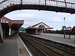
{{HS listed building row|commonscat=Aviemore railway station |date_listed= |grid_ref=NH8955312344 |hb=257 |image=Aviemore Station - geograph.org.uk - 573341.jpg |lat=57.188552 |location=[[Aviemore]] |lon=-3.829084 |name=[[Aviemore railway station]] |notes=[4]}}
|- class="vcard with_image;text-align:center" | class="fn org" | Aviemore railway station | class="label" | Aviemore | | NH8955312344 | 57°11′19″N 3°49′45″W / 57.188552°N 3.829084°W | class="note" | [4] | class="uid" | 257
|
Upload another image
See more images
{{HS listed building row/sandbox}}
|- class="vcard with_image;text-align:center" | class="fn org" | Aviemore railway station | class="label" | Aviemore | | NH8955312344 | 57°11′19″N 3°49′45″W / 57.188552°N 3.829084°W | class="note" | [4] | class="uid" | 257
|
References
[edit]- ^ "Sluggan Bridge Over River Dulnain: Listed Building Report". Historic Scotland.
- ^ "Muckrach Castle: Listed Building Report". Historic Scotland.
- ^ "Rothiemurchus, Croft House: Listed Building Report". Historic Scotland.
- ^ "Aviemore Railway Station With Island Platform, Footbridge And Fencing: Listed Building Report". Historic Scotland.
