Tawawa, Ohio
Appearance

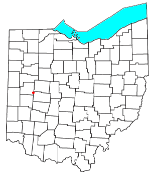
Tawawa is an unincorporated community in northeastern Green Township, Shelby County, Ohio, United States.[1] It lies along State Route 29 less than one mile (about 1½ km) away from the Champaign County border. Mosquito Creek, a tributary of the Great Miami River, flows northwestward along the southern edge of Tawawa. The community lies 8 miles (12¾ km) southeast of the city of Sidney, the county seat of Shelby County.[2]
History
[edit]
Tawawa was originally called New Palestine, and under the latter name was laid out in 1832.[3] A post office called Tawawa was established in 1848, and remained in operation until 1905.[4] The name Tawawa was the Native American name for Mosquito Creek.[5]
References
[edit]- ^ U.S. Geological Survey Geographic Names Information System: Tawawa, Ohio
- ^ DeLorme. Ohio Atlas & Gazetteer. 7th ed. Yarmouth: DeLorme, 2004, p. 55. ISBN 0-89933-281-1.
- ^ Hitchcock, Almon Baldwin Carrington (1913). History of Shelby County, Ohio, and representative citizens. p. 355.
- ^ "Shelby County". Jim Forte Postal History. Retrieved December 24, 2015.
- ^ History of Shelby County, Ohio: With Illustrations and Biographical Sketches of Some of Its Prominent Men and Pioneers. Sutton. 1883. p. 199.
40°20′44″N 83°55′50″W / 40.34556°N 83.93056°W

