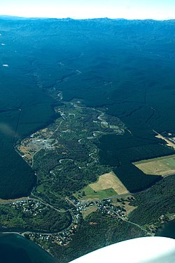
Tauranga Taupō River
Appearance
| Tauranga Taupō River | |
|---|---|
 Tauranga Taupō River and settlement | |
 | |
| Location | |
| Country | New Zealand |
| Physical characteristics | |
| Source | |
| • location | Kaimanawa Range |
| Mouth | |
• location | Lake Taupō |
| Length | 27 km (17 mi) |
The Tauranga Taupō River is a river of the Hawke's Bay and Waikato Regions of New Zealand's North Island. It flows northwest from its sources at the northern end of the Kaimanawa Range to reach the eastern shore of Lake Taupō close to the settlement of Rangiita, 12 kilometres (7 mi) northeast of Tūrangi.
See also
[edit]References
[edit]38°54′32″S 175°54′00″E / 38.908943°S 175.900037°E
