Tauhunu
Appearance

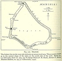
Tauhunu is both the main village on Manihiki atoll in the Cook Islands and the islet on which it is located. The village is the seat of the Manihiki Island Council. Tauhunu Islet is on the western rim of the atoll.[1]
Tauhunu is a village of native Manihikians (People of Manihiki and the seat of the Manihiki council).
References
[edit]- ^ Te Rangi Hiroa (1932). Ethnology of Manihiki and Rakahanga. Honolulu: Bernice P. Bishop Museum. p. 6. Retrieved 13 August 2020.
10°24′S 161°00′W / 10.400°S 161.000°W
