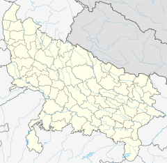
Tamkuhi Road railway station
Appearance
Tamkuhi Road Railway Station | |||||
|---|---|---|---|---|---|
| Indian Railways station | |||||
 Indian Railways logo | |||||
| General information | |||||
| Location | Agency Road, Tamkuhi Road, Kushinagar district, Uttar Pradesh India | ||||
| Coordinates | 26°43′28″N 84°13′32″E / 26.7244665°N 84.225471°E | ||||
| Elevation | 84 metres (276 ft) | ||||
| Owned by | Indian Railways | ||||
| Operated by | North Eastern Railway | ||||
| Line(s) | Kaptanganj–Thawe section | ||||
| Platforms | 2 | ||||
| Tracks | 3 | ||||
| Construction | |||||
| Structure type | Standard (on-ground station) | ||||
| Parking | No | ||||
| Bicycle facilities | No | ||||
| Accessible | No | ||||
| Other information | |||||
| Status | Single diesel line | ||||
| Station code | TOI | ||||
| Zone(s) | North Eastern Railway | ||||
| Division(s) | Varanasi | ||||
| History | |||||
| Opened | 1907 | ||||
| Rebuilt | 2011 | ||||
| Electrified | yes | ||||
| Previous names | Bengal and North Western Railway | ||||
| |||||
Tamkuhi Road railway station is a second important railway station of Kushinagar district after Padrauna (District Headquarters, kushinagar) (popularly known for its international buddha pilgrimage) of Uttar Pradesh. Its code is TOI. It serves Tamkuhi Road town. The station consists of two platforms. The platforms are not well sheltered. It lacks many facilities including water and sanitation.[1]
Tamkuhi Road was part of Bengal and North Western Railway constructed the 79 mi (127 km)-long 1,000 mm (3 ft 3+3⁄8 in)-wide metre-gauge line from Siwan to Kaptanganj in 1907.[citation needed]
The Kaptanganj–Thawe section was converted to 1,676 mm (5 ft 6 in)-wide 5 ft 6 in (1,676 mm) broad gauge in 2011.[2] https://m.facebook.com/satya5108946/
References
[edit]- ^ "TOI/Tamkuhi Road". India Rail Info.
- ^ Indian Railways: A Historical Perspective Archived 2014-01-09 at the Wayback Machine


