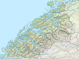
Talgsjøen
Appearance
| Talgsjøen | |
|---|---|
 Talgsjøen seen from Kvernberg in Kristiansund | |
| Location | Møre og Romsdal county, Norway |
| Coordinates | 63°8′42″N 7°52′19″E / 63.14500°N 7.87194°E |
| Basin countries | Norway |
| Max. length | 10.0 kilometres (6.2 mi) |
| Max. width | 3.0 kilometres (1.9 mi) |
| Max. depth | 341 metres (1,119 ft) |
| Surface elevation | 0 m (0 ft)[1] |
Talgsjøen is a small channel or fjord beyond Halsa Fjord between the municipalities of Kristiansund and Aure in Møre og Romsdal county, Norway.[2]
The ferry connection from Seivika on the island of Nordlandet in Kristiansund and Tømmervåg on the island of Tustna in Aure crosses Talgsjøen.[3]
References
[edit]- ^ "Talgsjøen, Kristiansund (Møre og Romsdal)" (in Norwegian). yr.no. Retrieved March 15, 2017.
- ^ Store norske leksikon: Kristiansund.
- ^ Tåke stoppet ferga og fly. 2014. Tidens Krav (April 25).


