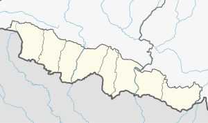
Surunga Municipality
Appearance
Surunga
सुरुङ्गा (Nepali) | |
|---|---|
| Municipality in Nepal | |
| Coordinates: 26°42′N 86°32′E / 26.70°N 86.53°E | |
| Country | Nepal |
| Development Region | Eastern |
| Zone | Sagarmatha |
| District | Saptari |
| Province | Madhesh |
| Municipality | Surunga |
| Government | |
| • Mayor | Gita Chaudhary (NC) |
| • Deputy Mayor | Rudra Bahadur Karki (NC) |
| Area | |
• Total | 107.04 km2 (41.33 sq mi) |
| Population (2017)[1] | |
• Total | 44,221 |
| • Density | 410/km2 (1,100/sq mi) |
| • Religions | Hindu Muslim Christian |
| Languages | |
| • Local | Maithili, Tharu, Nepali |
| Time zone | UTC+5:45 (NST) |
| Postal Code | 56417 |
| Area code | 031 |
| Website | www.surungamun.gov.np |
Surunga Municipality (Nepali: सुरुङ्गा नगरपालिका) is located in Saptari District in the Province 2 of Nepal. It was formed in 2016 occupying current 11 sections (wards) merging previous Pipra, Hardiya, Daulatpur, Madhupati, Kushaha, Haripur, Malhanwa, Tikulya, Pramanpur (ward no.09) and Patewarba VDCs.[2] It occupies an area of 107.04 km2 with a total population of 44,221.[1]
References
[edit]- ^ a b "Local Elections 2074 – Election Results Overview – Saptari – Surunga". Retrieved 1 September 2018.
- ^ "स्थानिय तह". 103.69.124.141. Archived from the original on 31 August 2018. Retrieved 1 September 2018.


