Stroudsburg–Pocono Airport
Stroudsburg–Pocono Airport | |||||||||||
|---|---|---|---|---|---|---|---|---|---|---|---|
| Summary | |||||||||||
| Airport type | Public use | ||||||||||
| Owner | Pocono Stroudsburg Airport Inc. | ||||||||||
| Serves | East Stroudsburg, Pennsylvania | ||||||||||
| Closed | March 1, 2002 | ||||||||||
| Elevation AMSL | 480 ft / 146 m | ||||||||||
| Coordinates | 41°02′09″N 075°09′38″W / 41.03583°N 75.16056°W | ||||||||||
| Map | |||||||||||
 | |||||||||||
| Runways | |||||||||||
| |||||||||||
| Statistics (2012) | |||||||||||
| |||||||||||
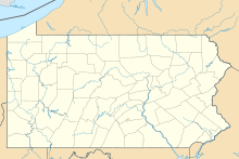
Stroudsburg–Pocono Airport (IATA: ESP, FAA LID: N53) was a privately owned, public use airport located three nautical miles (6 km) north of the central business district of East Stroudsburg, a borough in Monroe County, Pennsylvania, United States.[2] This airport was included in the National Plan of Integrated Airport Systems for 2009–2013, which categorized it as a general aviation facility.[3] The airport was permanently closed on March 1, 2022, when the property was sold to Black Buffalo 3D printing company.
Facilities and aircraft
[edit]Stroudsburg–Pocono Airport covered an area of 69 acres (28 ha) at an elevation of 480 feet (146 m) above mean sea level. It had one runway designated 8/26 with an asphalt surface measuring 3,087 by 30 feet (941 x 9 m).[2]
For the 12-month period ending January 13, 2012, the airport had 18,820 aircraft operations, an average of 51 per day: 99.9% general aviation and 0.1% military. At that time there were 34 aircraft based at this airport: 88% single-engine, 6% multi-engine, and 6% helicopter.[2]
The airport was home to the "Sky's The Limit" Skydiving Center, which operated six days a week (Wednesday to Monday) from April through November. The center regularly used a twin-turboprop de Havilland DHC-6 Twin Otter, a turboprop-powered Cessna 208 Caravan, and a piston-powered Cessna 182 Skylane — all configured for skydiving operations. The airport was also home to Lehigh Valley Health Network MedEvac 2. MedEvac 2 is the primary medical helicopter for Monroe, Pike, and Northampton Counties.
See also
[edit]References
[edit]- ^ "Airline and Airport Code Search". IATA. Retrieved 18 March 2016.
- ^ a b c d FAA Airport Form 5010 for N53 PDF. Federal Aviation Administration. Effective May 31, 2012.
- ^ "2009–2013 NPIAS Report, Appendix A: Part 4" (PDF). National Plan of Integrated Airport Systems. Federal Aviation Administration. October 15, 2008. Archived from the original (PDF, 1.61 MB) on June 6, 2011.
External links
[edit]- Stroudsburg Pocono Airport (N53) at Pennsylvania DOT Bureau of Aviation
- Aerial image as of April 1999 from USGS The National Map
- FAA Terminal Procedures for N53, effective October 31, 2024
- Resources for this airport:
- FAA airport information for N53
- AirNav airport information for N53
- FlightAware airport information and live flight tracker
- SkyVector aeronautical chart for N53


