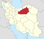
Sorkheh
Sorkheh
| |
|---|---|
City | |
 The historical Ab Anbar of Sorkheh | |
| Coordinates: 35°27′52″N 53°12′31″E / 35.46444°N 53.20861°E[1] | |
| Country | Iran |
| Province | Semnan |
| County | Sorkheh |
| District | Central |
| Government | |
| Elevation | 1,100 m (3,600 ft) |
| Population (2016)[2] | |
• Total | 9,951 |
| Time zone | UTC+3:30 (IRST) |
| Area code | 023 |
| Language(s) | Sorkhei, Persian |
| Website | sorkhe |
Sorkheh (Persian: سرخه)[a] is a city in the Central District of Sorkheh County, Semnan province, Iran, serving as capital of both the county and the district.[5]
Demographics
[edit]Language
[edit]Sorkhei, a Semnani dialect and language, is still spoken by some of its inhabitants.[citation needed]
Population
[edit]At the time of the 2006 National Census, the city's population was 9,062 in 2,686 households, when it was in the former Sorkheh District of Semnan County.[6] The following census in 2011 counted 9,711 people in 3,045 households.[7] The 2016 census measured the population of the city asf 9,951 people in 3,388 households,[2] by which time the district had been separated from the county in the establishment of Sorkheh County. Sorkheh was transferred to the new Central District as the county's capital.[5]
Notable people
[edit]- Abbas Ali Akhtari, Shia Cleric & Politician
- Hassan Rouhani (born 1948), 7th President of Iran[8]: 55
- Sahebeh Rouhani (born 1954), Iran's first lady (Hassan Rouhani's wife)
- Hossein Fereydoun (born 1957), Iranian politician.
- Ali Asqar Peyvandi (born 1962), Iranian physician and politician.
- Ruhollah Isari (born 1992), Futsal player.
See also
[edit]Notes
[edit]References
[edit]- ^ OpenStreetMap contributors (25 April 2023). "Sorkheh, Sorkheh County" (Map). OpenStreetMap (in Persian). Retrieved 25 April 2023.
- ^ a b "Census of the Islamic Republic of Iran, 1395 (2016)". AMAR (in Persian). The Statistical Center of Iran. p. 20. Archived from the original (Excel) on 17 November 2020. Retrieved 19 December 2022.
- ^ Sorkheh can be found at GEOnet Names Server, at this link, by opening the Advanced Search box, entering "-3086232" in the "Unique Feature Id" form, and clicking on "Search Database".
- ^ Borjian, Habib, “Sorḵa”, Encyclopaedia Iranica Online, 2013
- ^ a b Jahangiri, Ishaq (27 December 2019). "Letter of approval regarding Momenabad Rural District of Semnan province; and Letter of approval regarding country divisions in Semnan County, Semnan province". Qavanin (in Persian). Ministry of Interior, Council of Ministers. Archived from the original on 25 April 2023. Retrieved 22 November 2023.
- ^ "Census of the Islamic Republic of Iran, 1385 (2006)". AMAR (in Persian). The Statistical Center of Iran. p. 20. Archived from the original (Excel) on 20 September 2011. Retrieved 25 September 2022.
- ^ "Census of the Islamic Republic of Iran, 1390 (2011)". Syracuse University (in Persian). The Statistical Center of Iran. p. 20. Archived from the original (Excel) on 20 January 2023. Retrieved 19 December 2022.
- ^ Rouhani, Hassan (2008). Memoirs of Hassan Rouhani; Vol. 1: The Islamic Revolution (in Persian). Tehran, Iran: Center for Strategic Research. ISBN 978-600-5914-80-1.


