Solanco School District
| Solanco School District | |
|---|---|
 | |
| Address | |
121 S Hess Street
Quarryville , Lancaster County, Pennsylvania, 17566-1225United States | |
| District information | |
| Grades | K-12th |
| Students and staff | |
| District mascot | Golden Mules |
| Colors | Black, gold |
| Other information | |
| Website | solancosd |
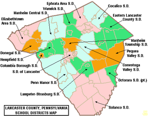
Solanco School District is a large, rural public school district located in the southern end of Lancaster County (SoLanCo - Southern Lancaster County), Pennsylvania. Solanco School District encompasses approximately 180 square miles (470 km2). Solanco School District serves: Providence Township, Eden Township, Quarryville Borough, Little Britain Township, Bart Township, Colerain Township, Drumore Township, East Drumore Township and Fulton Township. According to 2008 local census data, it served a resident population of 30,566. By 2010, the district's population increased to 31,871 people.[1] In 2009, the district residents’ per capita income was $17,040, while the median family income was $49,432.[2] In the Commonwealth, the median family income was $49,501[3] and the United States median family income was $49,445, in 2010.[4]
The district operates seven schools: four elementary, two middle/junior high, one high school and a virtual academy (K-12).
- Elementary schools are:
- Quarryville Elementary School
- Providence Elementary School
- Bart-Colerain Elementary School
- Clermont Elementary School
- Middle schools:
- George A. Smith Middle School
- Swift Middle School
- High school:
Extracurriculars
[edit]Solanco School District offers a variety of clubs, activities and an extensive sports program.
Sports
[edit]The district funds:
|
|
- Junior High School Sports
|
|
According to PIAA directory July 2012[5]
References
[edit]- ^ US Census Bureau, 2010 Census Poverty Data by Local Educational Agency, 2011
- ^ US Census Bureau, American Fact Finder, 2009
- ^ US Census Bureau (2010). "American Fact Finder, State and County quick facts".
- ^ US Census Bureau (September 2011). "Income, Poverty, and Health Insurance Coverage in the United States: 2010" (PDF).
- ^ Pennsylvania Interscholastic Athletics Association (2012). "PIAA School Directory".

