Smisby
| Smisby | |
|---|---|
 Smisby's church of St. James. The church was originally dedicated to Saint Wystan of Repton and is mentioned in a charter of 1271.[1] | |
Location within Derbyshire | |
| Population | 270 (2011) |
| OS grid reference | SK3419 |
| Civil parish |
|
| District | |
| Shire county | |
| Region | |
| Country | England |
| Sovereign state | United Kingdom |
| Post town | ASHBY-DE-LA-ZOUCH |
| Postcode district | LE65 |
| Dialling code | 01530 |
| Police | Derbyshire |
| Fire | Derbyshire |
| Ambulance | East Midlands |
| UK Parliament | |
Smisby is an ancient manor, civil parish and small village in South Derbyshire, England. It is 4 miles (6.4 km) from Melbourne and near the Leicestershire border[2] and the town of Ashby-de-la-Zouch. The village including the outlying farms and houses has a population just over 200 that occupies some 110 properties. The population at the 2011 Census had increased to 260.[3]
Early history
[edit]Smisby (Old Norse Smith's farm or settlement[4]) is mentioned as Smidesbi in 1086 in the Domesday Book,[5] which states[6] under the title of "The lands of Nigel of Stafford":[7]
In Smisby, Edwin had two carucates of land to the geld. There is land for 2 ploughs. There is now one plough in demesne and three villans have one plough. There is woodland pasture half a league long and six leagues broad. TRE[8] worth 40 shillings now twenty shillings.
The Smisby lock-up is a village lock-up dating from the 18th century. Considered the best exemplar of the type in the county, it is a Grade II* listed building.[9]
Notable residents
[edit]- Hannah Bailey, an early emigrant to New Zealand, was born here on 2 February 1802. She married Charles Baker [later Rev.] of Packington on 11 May 1827 at St Mary's Church Islington, London, before leaving for the Mission fields in Bay of Islands, New Zealand, where they served as Missionaries to the Māori from 1828 until their deaths in 1875.
- Reuben Bosworth the clockmaker was born here around 1797.
Ivanhoe
[edit]Within 200 metres of the village is a spot where a tournament was held that was described by Sir Walter Scott in his novel Ivanhoe. In chapter seven the text reads
The scene was singularly romantic. On the verge of a wood, which approached to within a mile of the town of Ashby, was an extensive meadow, of the finest and most beautiful green turf, surrounded on one side by the forest, and fringed on the other by straggling oak-trees, some of which had grown to an immense size. [10]
This quotation is attributed to a visit Scott made to Coleorton Hall to visit Sir George Beaumont. They visited Smisby and climbed a now-demolished watchtower. Scott noted that a flat area towards Ashby Castle, but within Derbyshire, was reputed to be the place where ancient jousting tournaments had taken place.[1][11]
Gallery
[edit]-
The Smisby lock-up
-
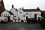
Smisby Arms
See also
[edit]References
[edit]- ^ a b Smisby local site accessed 28 December 2007
- ^ Smisby at Genuki accessed 28 December 2007
- ^ "Civil Parish population 2011". Neighbourhood Statistics. Office for National Statistics. Retrieved 20 March 2016.
- ^ "Smisby". Key to English Place-names. English Place Name Society at the University of Nottingham. Retrieved 21 August 2013.
- ^ Smisby is spelt Smidesbi in Domesday.
- ^ Domesday Book: A Complete Translation. London: Penguin, 2003. ISBN 0-14-143994-7 p.753
- ^ Nigel of Stafford held a considerable number of manors including several in Derbyshire given to him by the King. In addition to Smisby they included lands in Stapenhill, Swadlincote, Ingleby, Ticknall and Foremark, as well as Ravenstone, Donisthorpe, Oakthorpe and Trangesby in Leicestershire).
- ^ TRE in Latin is Tempore Regis Edwardi. This means in the time of King Edward before the Battle of Hastings.
- ^ Historic England. "The Lock Up (Round House) (Grade II*) (1281737)". National Heritage List for England. Retrieved 12 November 2022.
- ^ Ivanhoe by Sir Walter Scott accessed 27 December 2007
- ^ Ordnance survey map 1880–1890


