Semčice
Semčice | |
|---|---|
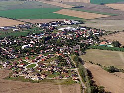
 Aerial view | |
| Coordinates: 50°22′6″N 15°0′25″E / 50.36833°N 15.00694°E | |
| Country | |
| Region | Central Bohemian |
| District | Mladá Boleslav |
| First mentioned | 1297 |
| Area | |
• Total | 3.97 km2 (1.53 sq mi) |
| Elevation | 237 m (778 ft) |
| Population (2024-01-01)[1] | |
• Total | 754 |
| • Density | 190/km2 (490/sq mi) |
| Time zone | UTC+1 (CET) |
| • Summer (DST) | UTC+2 (CEST) |
| Postal code | 294 46 |
| Website | www |
Semčice is a municipality and village in Mladá Boleslav District in the Central Bohemian Region of the Czech Republic. It has about 800 inhabitants.
Etymology
[edit]The name is derived from the personal name Semek, meaning "the village of Semek's people".[2]
Geography
[edit]Semčice is located about 8 kilometres (5 mi) southeast of Mladá Boleslav and 45 km (28 mi) northeast of Prague. It lies on the border between the Jičín Uplands and Jizera Table. The highest point is at 312 m (1,024 ft) above sea level. The Vlkava River flows through the southern part of the municipality.
History
[edit]The first written mention of Semčice is from 1297.[3] Until the 17th century, it was a small estate owned by various less important noble families. After the Battle of White Mountain in 1620, Semčice was acquired by the Waldstein family and annexed to the Dobrovice estate.[4]
Demographics
[edit]
|
|
| ||||||||||||||||||||||||||||||||||||||||||||||||||||||
| Source: Censuses[5][6] | ||||||||||||||||||||||||||||||||||||||||||||||||||||||||
Transport
[edit]There are no railways or major roads passing through the municipality.
Sights
[edit]
The main landmark of Semčice is the Church of Saint Procopius. It was built in the Baroque style in the mid-18th century, according to the design by František Ignác Prée.[7]
References
[edit]- ^ "Population of Municipalities – 1 January 2024". Czech Statistical Office. 2024-05-17.
- ^ Profous, Antonín (1957). Místní jména v Čechách IV: S–Ž (in Czech). p. 39.
- ^ "Obec Semčice" (in Czech). Obec Semčice. Retrieved 2024-06-05.
- ^ "Historie obce" (in Czech). Obec Semčice. Retrieved 2024-06-05.
- ^ "Historický lexikon obcí České republiky 1869–2011" (in Czech). Czech Statistical Office. 2015-12-21.
- ^ "Population Census 2021: Population by sex". Public Database. Czech Statistical Office. 2021-03-27.
- ^ "Kostel sv. Prokopa" (in Czech). National Heritage Institute. Retrieved 2024-06-05.
External links
[edit]


